Dinard is ten minutes across the water from Saint-Malo, and a world apart. On one side, ramparts and corsair granite; on the other, Belle Époque villas, tamarisks and the striped bathing tents of a resort born of 19th-century English holidaymaking. It is the most obvious of the day trips. For anyone here for the tide, it is also an observation post Saint-Malo itself cannot offer: its own silhouette ringed by high water.
Crossing: the finest journey in the bay
The sea bus links the Dinan slipway, below the ramparts, to the Dinard slipway in about ten minutes, all year round except in heavy weather. The crossing is an excursion in itself: the môle des Noires, the Solidor tower and the mouth of the Rance file past, and you land at the foot of the Clair de Lune promenade. By car, the loop over the Rance barrage takes twenty-five minutes and stages its own show. But on busy days, the boat always wins.
The tide, seen from the opposite shore
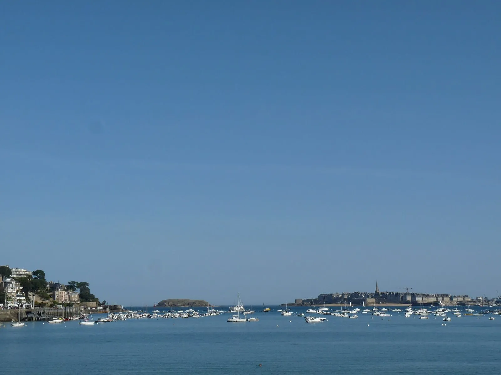
This is Dinard’s great argument for readers of this site: the head-on view of Saint-Malo. From the Moulinet headland, which closes Écluse beach, or from Prieuré beach, the corsair city stands cut out against the water, Grand Bé and Fort National set around it. At a big-coefficient high water the town seems to float on the water; the Dinard shore, less exposed to swell than the Saint-Malo seafront, lets you enjoy it without taking the spray. The viewpoints page ranks the Moulinet among the best posts in the whole bay.
At low tide, Dinard follows its own rhythm: the Écluse and the Prieuré stretch out their sands, pools appear at the feet of the headlands, and the Clair de Lune promenade, winding between exotic gardens and villas above the estuary, overlooks a landscape that empties and refills twice a day.
The model half-day
Cross by sea bus, climb the Moulinet headland for the panorama, stroll the Clair de Lune towards the port, then Écluse beach and its listed villas, all on foot, without a car. Walkers push on to the Malouine headland and its perched villas, or further towards Saint-Énogat. On the way back, if the times allow, aim for a crossing around high water: the full roadstead is Saint-Malo at the top of its game. The hours shift every day: check the official SHOM tide times, and the spring tide calendar to aim for a big coefficient.
Every place on this page appears in the list below and on the interactive map, each with its detailed entry.
The path hugging the estuary at water level, from the sea-shuttle jetty to Prieuré beach, sheltered from the open-sea wind. The Rance microclimate grows palms, agaves and mimosas here among the listed villas. On summer evenings the promenade is lit and set to music. Across the water, the ramparts of Saint-Malo change their pedestal with the tide: set on the water at high tide, perched on the sand on the ebb. Walk it at two different hours and you see two landscapes. A gentle stroll at any hour, in almost any weather, and at its best after dark.
Dinard – Pleurtuit airport
Dinard – Saint-Lunaire
The Emerald Coast's small airport, on the Pleurtuit plateau, fifteen minutes from both Dinard and Saint-Malo via the Rance dam. It operates scheduled or seasonal links to Great Britain and the Channel Islands. Routes change with the seasons and the airlines: check the current offer before building a trip around it. Car hire on site; no rail connection, so plan your onward transfer in advance. On arrival, the drive across the dam gives an immediate first glimpse of the estuary and its tidal range.
Écluse beach (Dinard)
Dinard – Saint-Lunaire
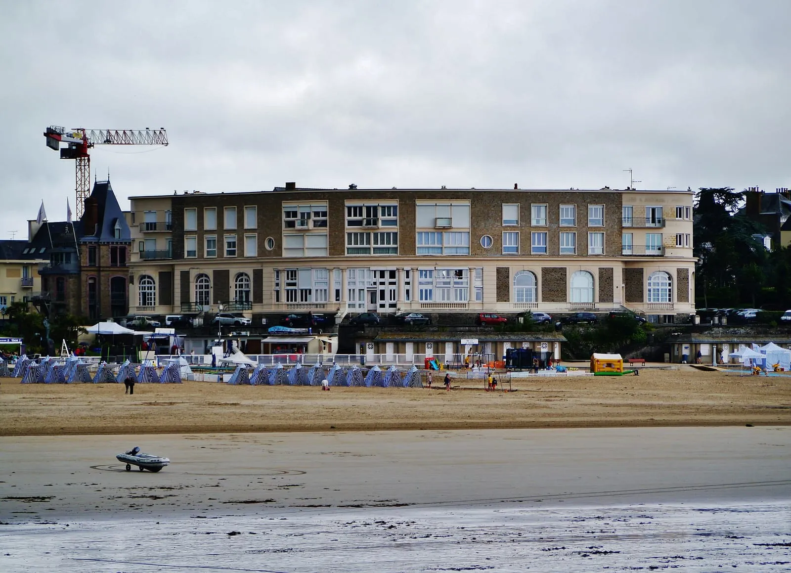
Dinard's central beach, trimmed with its blue-and-white striped tents, between the Pointe du Moulinet and the Pointe de la Malouine. The Belle Époque setting (casino, listed villas, bathing huts) has been the resort's picture for 150 years; Picasso painted here over several summers. The tide makes two beaches of it: a generous low-water expanse of sand for games and long walks, and a high tide that brings the water right up towards the huts. A seawater pool sits at one end, precious when the sea is far out, with lifeguards in summer. Out to sea, the island of Cézembre and, to the right, the ramparts of Saint-Malo.
Garde Guérin headland
Dinard – Saint-Lunaire
Saint-Briac's great lookout, west of Dinard: a heathland promontory in the care of the coastal conservancy, with a view sweeping the whole Emerald Coast from Cap Fréhel to the ramparts of Saint-Malo. On spring tides you take in the scale of the tidal range at a glance: the Agot and Dame Jouanne islands join the shore at low water, then become islands again within hours. If you do walk out, check the official tide times first and turn back well before the flood. Reached by the coastal path or past the Dinard golf course; in heavy weather, the top of the promontory is the safest post.
Hôtel Printania (Dinard)sea view
Dinard – Saint-Lunaire · €€
Above the Clair de Lune promenade in Dinard, a house of tradition with an unabashedly Breton décor: box beds, faience, regional furniture. The estuary-side rooms hold Saint-Malo in the window: set on the water at high tide, raised above a wide foreshore when the sea withdraws and the Rance uncovers its strands. This is the opposite shore, the one that looks back at the ramparts, with Dinard's sheltered mildness thrown in. The sea-shuttle jetty is five minutes along the promenade: a ten-minute crossing down the estuary, and you step ashore at the foot of the ramparts.
Lancieux main beach
Dinard – Saint-Lunaire
Facing the Ébihens island, Lancieux's main beach unrolls more than a kilometre of west-facing sand. The sunsets, among the finest on the Emerald Coast, are best savoured from the dune when high water arrives at the end of the day. At low water on a big coefficient the sea retreats a very long way, uncovering a vast expanse of firm sand for walking, foraging and kite-flying: the whole landscape changes scale before your eyes. Swimming is best on the rising tide, when the water sweeps back in over the sun-warmed sand and picks up a few welcome degrees.
Longchamp beach (Saint-Lunaire)
Dinard – Saint-Lunaire
The great beach between Dinard and Saint-Lunaire, one of the most extensive on the Emerald Coast, framed by the Pointe du Décollé and the Pointe de la Garde Guérin. Facing north-west, it is the local surf and sea-wading spot when the swell gets in. The tide changes everything here: at low water the sand uncovers for hundreds of metres, room for walkers, sandcastles and great washes of light; then the flood gradually narrows the beach and draws bathers back up the sand. Less urban than the Écluse, more family-friendly than wild, and the coast path leaves from both ends, stretching the day out along the clifftops.
Pointe de la Malouine (Dinard)
Dinard – Saint-Lunaire
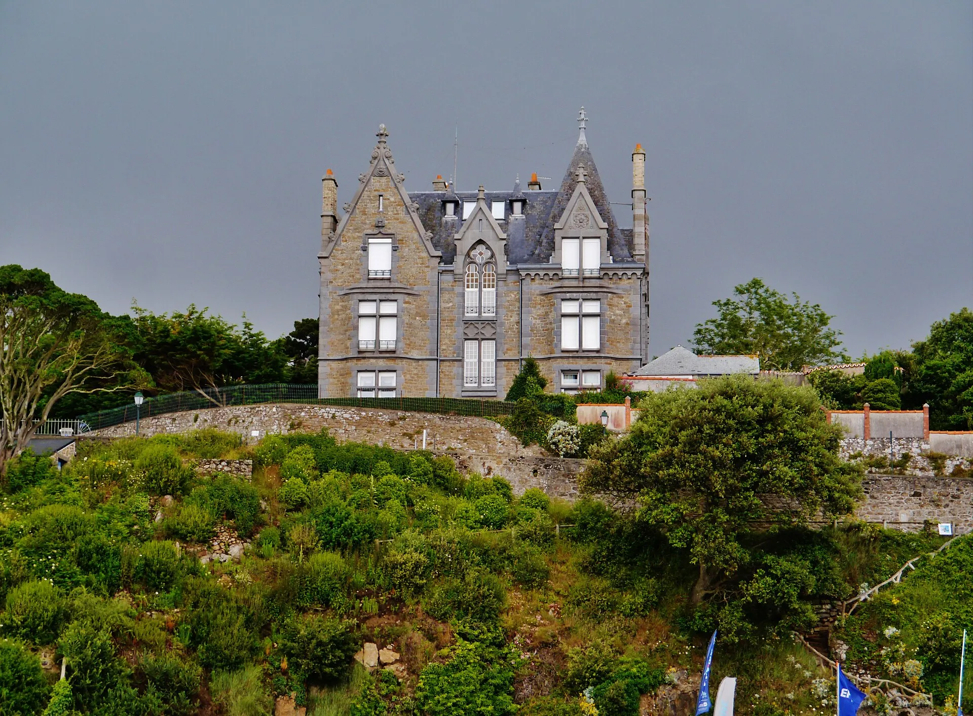
Dinard's other point, west of Écluse beach, developed in the Belle Époque with the resort's largest villas: turrets, loggias and English names carved on the gateposts. The path rounding it at rock level looks due north towards Cézembre and the Ébihens: at a spring tide with swell, the breakers frame the villas, and the contrast makes for fine pictures of the Emerald Coast. On such days, watch from a distance and under cover, from the higher ground, never from the sections at water level; check the official tide times before taking the path on a rising tide.
Pointe de la Vicomté (Dinard)
Dinard – Saint-Lunaire
South of Dinard, the Pointe de la Vicomté closes the entrance of the Rance opposite the Alet headland. The coastal path here gives the best overview of the estuary: the tidal power dam upstream, the cove and moorings below, Saint-Malo and the Solidor tower across the water. When the turbines run, you watch the Rance flow like a river, one way and then the other, while the moored boats swing round with the current. Here the level owes as much to the power station as to the moon: a good place to understand this tamed tide, in comfort, from a path set well above the water.
Pointe du Décollé (Saint-Lunaire)
Dinard – Saint-Lunaire
In Saint-Lunaire, ten minutes from Dinard, the Pointe du Décollé juts out as a granite spur above the sea. A stone bridge, the natural bridge of the Décollé, ties it to the shore above a chasm where the swell rushes in noisily at spring tides: enjoy the rumble from the bridge without leaning over, and from a distance in heavy weather. The view takes in the whole Emerald Coast, from Cap Fréhel to Saint-Malo. Access is free; the Sirens' cave below is revealed at low tide. Check the official tide times before climbing down, as the sea reclaims the foot of the rocks quickly.
Pointe du Moulinet (Dinard)
Dinard – Saint-Lunaire
At the entrance to Dinard, this point bristling with Belle Époque villas faces the ramparts of Saint-Malo across the Rance estuary. It is the best place to see the corsair city “set upon the sea” at high water, then ringed with sand at low water. The tidal range reads in a single glance, ideally by catching both ends of the tide. The promenade rounds the point at water level; on rising spring tides, some sections get licked by the waves: check the official tide times before going down, and on days of swell watch from a distance and under cover, from the higher ground of the point.
The sea bus crosses the roadstead in about ten minutes between the Dinan slipway, below the ramparts, and the Dinard slipway, year-round except in heavy weather. It is by far the finest approach. By car, allow twenty-five minutes via the Rance barrage; with fair weather, the boat wins every time.
What can you see in Dinard in half a day?
The classic triangle: the Moulinet headland with its head-on view of Saint-Malo, the Clair de Lune promenade along the estuary, and Écluse beach lined with Belle Époque villas and striped bathing tents. Every place in the list below has its own entry, with what the tide changes there.
Why come to Dinard on a spring tide day?
Because the best view of Saint-Malo ringed by high water is here: from the Moulinet or Prieuré beach, the corsair city seems to float, islets and forts around it. This shore is also less exposed to spray than the Saint-Malo seafront: the show without the soaking. At low tide, the Écluse and the Prieuré uncover broad sweeps of sand.


_Vue_sur_la_cit%C3%A9_corsaire_de_Saint-Malo_et_le_Grand_B%C3%A9_depuis_la_plage_du_Prieur%C3%A9.jpg)

