A spring tide in Saint-Malo is worth watching twice: at high water, when the Channel fills the bay to the brim of the sea walls, and at low water, when it hands back miles of foreshore. But you have to be in the right place. This page gathers the best observation posts around the bay (each with its own entry and its position on the map) along with the rules that go with them.
At high water: the show
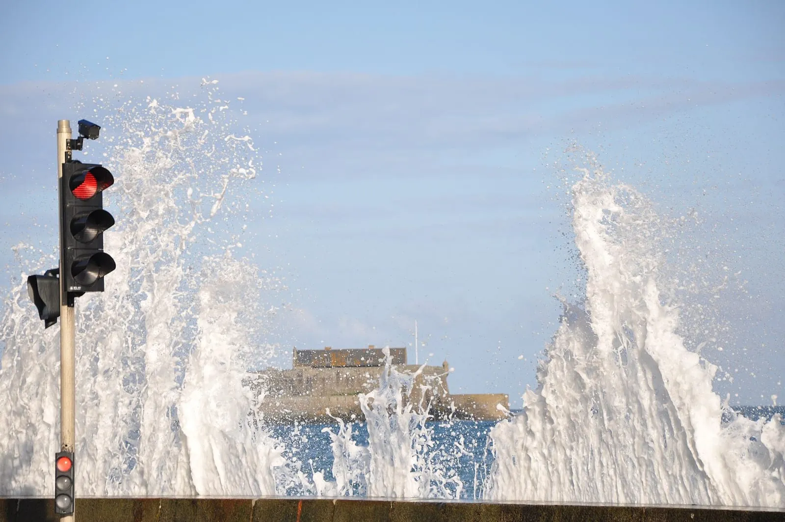
The classic post is the ramparts of the walled city: high up, sheltered, with Fort National and the islets in the line of sight. This is where a big-coefficient high water is best watched, even in a storm. On the Sillon, take the measure of the waves from the town side of the promenade; on days when the swell joins in, the sea leaps the wall and the seafront becomes the front row of a theatre, literally from the bedroom for those staying in a sea-view hotel.
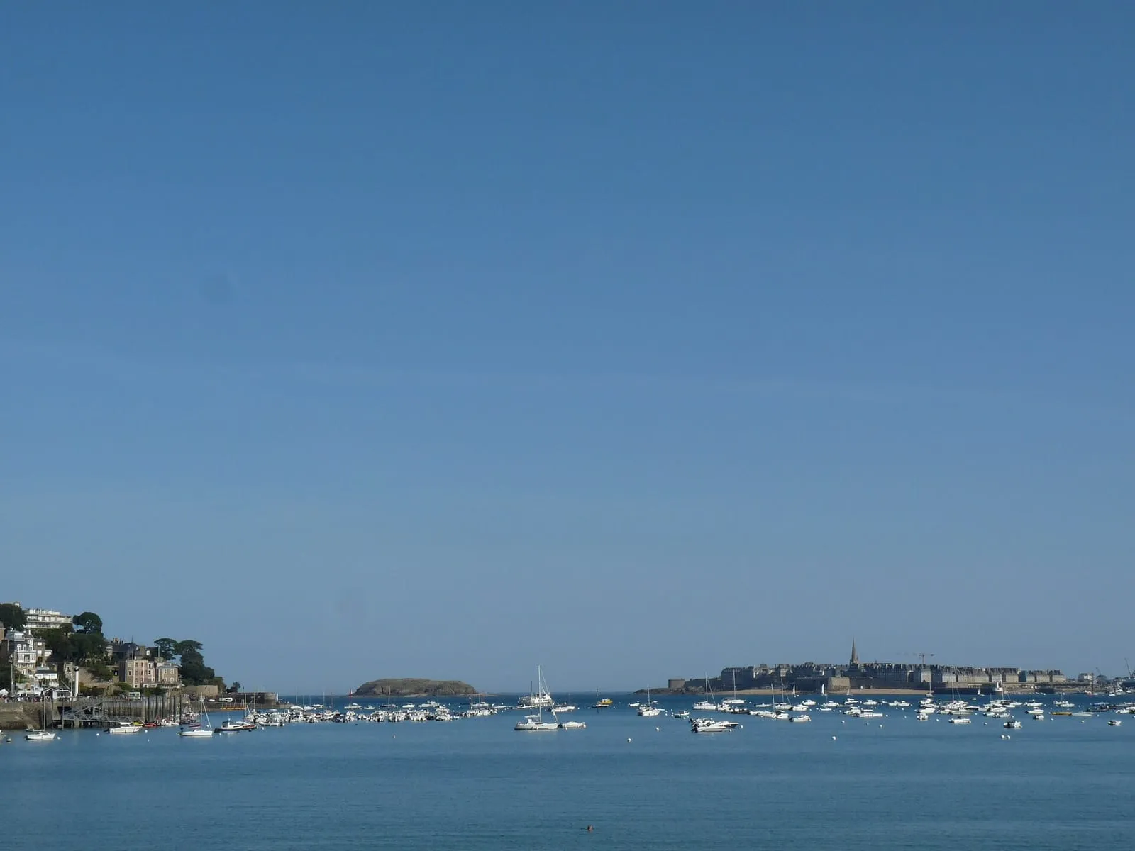
Across the roadstead, the Alet headland and Dinard’s Moulinet headland give you the wide shot: the corsair city ringed by water, the môle des Noires taking the seas, the port traffic hanging on slack water. Further out, the headlands of the coast (La Varde, Le Décollé, Le Grouin) watch the current accelerate and the sea change face within minutes.
Three circuits, depending on your time
One hour. Climb the seaward ramparts, from the Hollande bastion to the Bidouane tower, for high water, then come back down by the castle esplanade. Zero logistics, the best of the show.
Half a day. High water from the ramparts, then the Sillon promenade out to Rochebonne on the ebb, as the beach reappears beneath the breakwaters. Or the left-bank variant: sea bus to Dinard, up to the Moulinet headland, back along the Clair de Lune promenade, the whole roadstead in the frame.
A full day. Combine both windows: morning high water in town, low tide on the foreshore or out to the islets at midday, then drive out to a headland for the evening high water; La Varde to stay close, the Pointe du Grouin or Cap Fréhel for high water off the cliffs. The entries below give each post’s orientation and exposure.
At low water: the other show
Six hours later, the same bay has emptied. The foreshore uncovers its sandbanks, rocks and causeways to the islets, another, equally spectacular way to grasp the tidal range. It is a world of its own, with its own rules: we devote a full page to it, Saint-Malo at low tide.
Picking your moment
The high-water show plays out in a short window (the hour either side of slack), and the times shift every day. The spring tide calendar gives the year’s dates and coefficients; for the precise time of high water, check the official SHOM tide times before you set out.
One detail that changes everything: arrive before the time of high water, not on the hour. The last twenty minutes of the flood (as the sea reaches for its final centimetres) are often the most impressive, and the best places on the ramparts go fast on big-coefficient days.
One last word, always the same: in heavy weather, the best posts are the sheltered ones. The sea wall, the breakwater and the slipways turn into traps as soon as waves clear the parapet. Watch the show from a safe distance, behind shelter. The list below distinguishes observation posts from danger points: read the entries before you go.
⚠ Places marked “low tide only” can only be reached at low tide: check the official SHOM tide times before crossing. Official tide times (SHOM) ↗
The Sillon
Main beach first-aid station
The Sillon
The main lifeguard station of the Sillon's Grande Plage, staffed in the summer season. The lifeguards post the flag colour, the day's tide times and the supervised bathing zones. Worth a look before letting children into the water on a beach where the sea advances several hundred metres in a few hours. Spot the station as you arrive and stay within the supervised zone, directly in front of it. Out of season, bathing is unsupervised and swimmers are on their own: double your caution, check the official tide times, and beware how quickly the flood advances over sand as flat as this.
Lifeguarded in the summer season (July–August).
Sillon sea wall
The Sillon
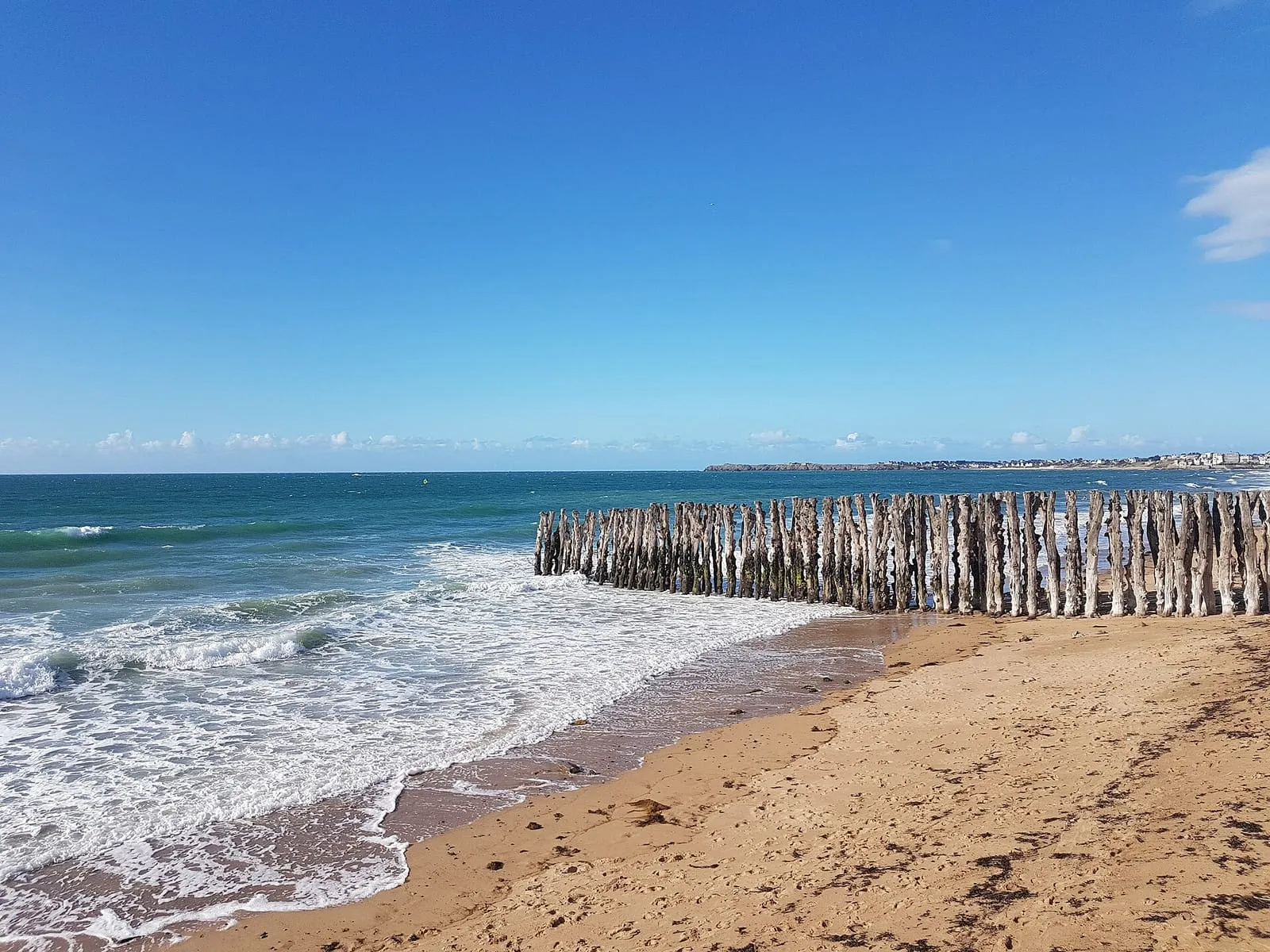
Three kilometres of seafront facing the open sea, from the foot of the ramparts to Rochebonne. This is where Saint-Malo's tides are seen at their best: on a big coefficient with a north-westerly swell, waves leap the wall at high tide, the surge the crowds come to photograph. At low water the beach opens out wide at the foot of the wooden breakwater posts planted in the sand to break the swell, the rows that give the Sillon its silhouette. Check the official tide times before you come. At a stormy high tide, watch from a distance and under cover, from the hotels or the set-back streets, never from the wall itself.
The waves that clear the sea wall on spring-tide days with swell are not a game: the falling mass of water can knock an adult over and drag them seaward, and fatal accidents have happened here. The danger peaks around high water, when any set of swell can hurl a wall of sea over the parapet without warning. On high-risk days the town closes access to the wall. Respect the barriers, even between waves. Check the official tide times before heading out: the show is to be watched from set-back streets, windows and terraces, never from the parapet or the beach.
The horseshoe watchtower at the north-western corner of the ramparts, a former powder magazine, commands the exact axis of the islets: Grand Bé, Petit Bé, Cézembre offshore. It is the classic photographer's post for sunsets and equinox high tides. The sea strikes the rock just below, and the crash carries up to the wall-walk. The adjoining esplanade carries Surcouf's statue; from here one glance takes in everything the tide uncovers or reclaims to the west. On spring-tide evenings with swell, spray clears the parapet: watch from further back, under cover, and never lean on a wall the waves are striking.
The black spot of Saint-Malo rescues: the causeway between Bon-Secours and the Grand Bé floods from mid-rising-tide, and every spring tide traps walkers who lingered too long on the islet. The sea does not cut the crossing off all at once: it rises quietly from both sides simultaneously, and the way back quickly becomes impassable. Check the official tide times before crossing, keep a generous margin on the hour given, and head back as soon as the water touches the causeway, even if others linger on. Never, under any circumstances, attempt to swim across.
At the south-western corner of the ramparts, this cannon-lined bastion overlooks the Môle des Noires and the chessboard of islets: Grand Bé, Petit Bé, Cézembre offshore. Few posts measure the tidal range better: six hours apart, the sea pounds the foot of the wall, then gives way to hundreds of metres of sand. Time your walk around high water, when the city seems set upon the sea, or come at low tide to read the bared foreshore. The full wall-walk runs 1.7 km and can be strolled freely at any hour; this bastion is its most maritime lookout, facing the sunset. In heavy swell, spray sweeps the stone: keep well back from the parapet.
The half-kilometre pier protecting the outer harbour runs due west, its light at the tip. In a spring-tide storm, walls of water sweep right over it: access is then closed by municipal order, and walkers have been swept off it before. The sight, the fiercest in the bay, is to be watched from a distance and under cover, from the Bon-Secours slipway or the set-back esplanade, never from the pier itself. In calm weather, the walk out to the light gives the finest low-angle view of the ramparts and the harbour entrance; check the official tide times and the state of the sea before setting out along it.
Southern Saint-Malo – station
Corbières park
Southern Saint-Malo – station
Saint-Servan's balcony over the Rance: a wooded park clinging to the cliff between the Solidor slipway and Quelmer, with plunging views of the dam, the Bizeux rock and the boats working through the lock. The path running through it is one of Saint-Malo's finest urban walks, sheltered from the wind on stormy days, a comfortable lookout when the open coast is best left alone. The scene shifts with the water level: a full, smooth estuary at high tide, then, at low water, the muddy foreshores fringing the park laid bare, a landscape to admire from the path, never to walk out on.
Naye lock: harbour area
Southern Saint-Malo – station
The lock that keeps the docks afloat despite the tidal range sets the rhythm of all Saint-Malo navigation: openings only happen around high water, when the open sea rises level with the basins. This is a working harbour area: moving bridges, lock chamber, strong currents nearby. Swimming and fishing are strictly forbidden, pedestrian crossing closes during manoeuvres, and children should be kept close behind the barriers. Curiosity from the quaysides is welcome, though: watching the chamber rise and fall with each passage is a tide show in itself, at its best around high water.
The sea wall carries on eastwards past the Sillon, along Paramé and Rochebonne, with the same head-on encounter with the open sea but half the crowd. On the days when “the sea leaps”, the plumes fly as high as on the Sillon: watch them from a distance and under cover, from the set-back terraces, never from the wave-battered parapet. At low tide the beach uncovers several hundred metres. It is the haunt of shore foragers and long winter walks, when the light skims the wet sand. Check the official tide times before heading onto the flats: the sea returns quickly over ground this level.
This heathland promontory between the Minihic and Le Val closes the bay to the east, some thirty metres above the water. A former military site (blockhouses of the Atlantic Wall remain), it is now a protected natural area crossed by the customs officers' path (GR 34). The view sweeps full circle: the Saint-Malo roadstead and the Sillon on one side, the coast towards Rothéneuf and Cancale on the other. At spring tides, foam bursts over the reefs at the foot of the point: its height makes it a safe post for watching heavy weather from afar. Even so, keep to the paths, well back from the cliff edge.
Rothéneuf inlet: caution
Rothéneuf
The Rothéneuf inlet empties and refills through a narrow channel: on the flood, the current reaches the speed of a river in spate and the sandbanks at the back of the cove become cut off very quickly. Walkers heading for Besnard island or crossing the inlet at low tide must turn back at slack water. The rising tide cuts the low points first, behind you, where nobody is looking. Check the time of low water before stepping onto the sand and keep a generous margin. Swimming in the channel at mid-tide is unwise even for strong swimmers: whichever way the current runs, it is stronger than you are.
Saint-Briac's great lookout, west of Dinard: a heathland promontory in the care of the coastal conservancy, with a view sweeping the whole Emerald Coast from Cap Fréhel to the ramparts of Saint-Malo. On spring tides you take in the scale of the tidal range at a glance: the Agot and Dame Jouanne islands join the shore at low water, then become islands again within hours. If you do walk out, check the official tide times first and turn back well before the flood. Reached by the coastal path or past the Dinard golf course; in heavy weather, the top of the promontory is the safest post.
Pointe de la Malouine (Dinard)
Dinard – Saint-Lunaire
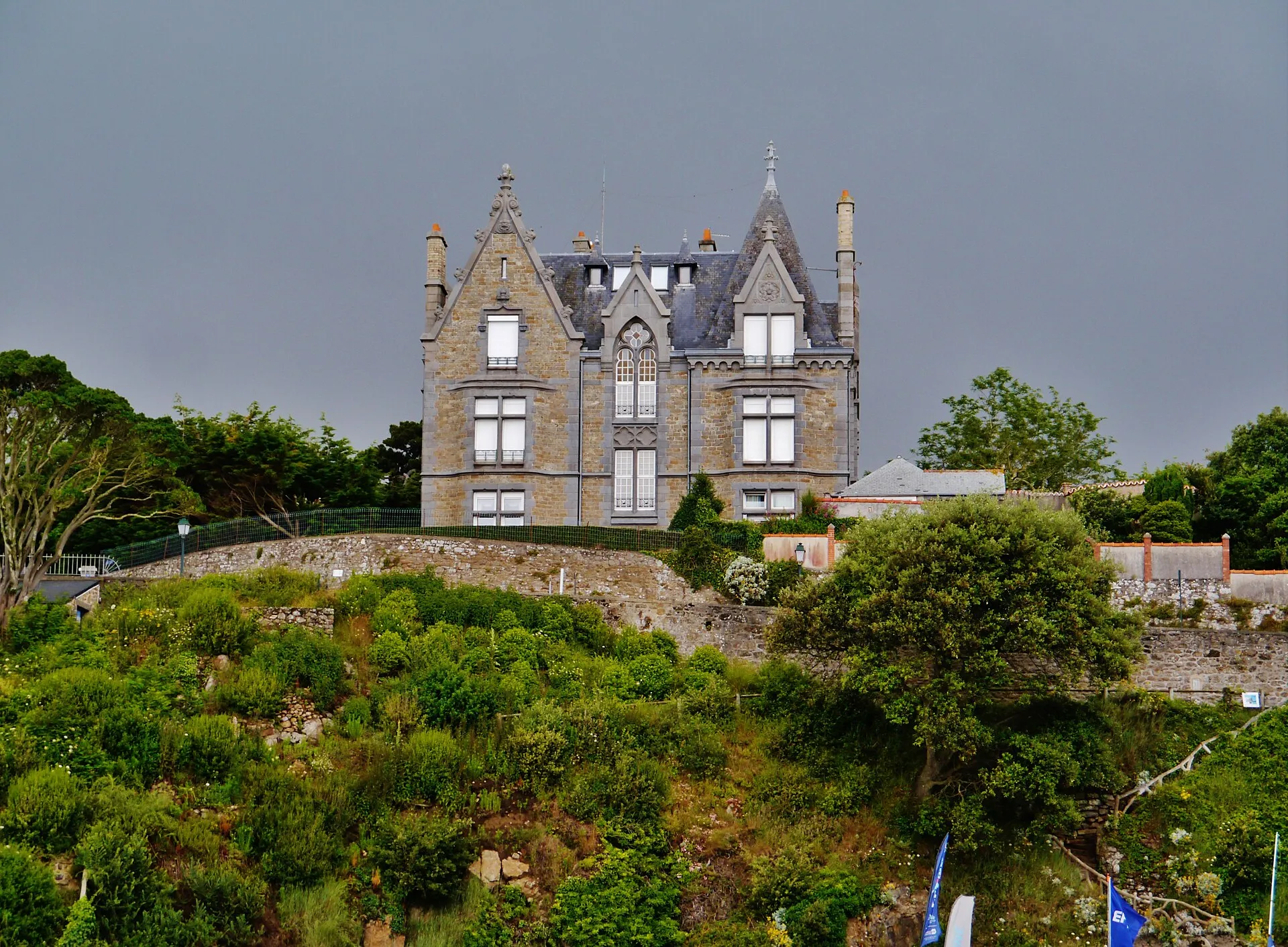
Dinard's other point, west of Écluse beach, developed in the Belle Époque with the resort's largest villas: turrets, loggias and English names carved on the gateposts. The path rounding it at rock level looks due north towards Cézembre and the Ébihens: at a spring tide with swell, the breakers frame the villas, and the contrast makes for fine pictures of the Emerald Coast. On such days, watch from a distance and under cover, from the higher ground, never from the sections at water level; check the official tide times before taking the path on a rising tide.
Pointe de la Vicomté (Dinard)
Dinard – Saint-Lunaire
South of Dinard, the Pointe de la Vicomté closes the entrance of the Rance opposite the Alet headland. The coastal path here gives the best overview of the estuary: the tidal power dam upstream, the cove and moorings below, Saint-Malo and the Solidor tower across the water. When the turbines run, you watch the Rance flow like a river, one way and then the other, while the moored boats swing round with the current. Here the level owes as much to the power station as to the moon: a good place to understand this tamed tide, in comfort, from a path set well above the water.
Pointe du Décollé (Saint-Lunaire)
Dinard – Saint-Lunaire
In Saint-Lunaire, ten minutes from Dinard, the Pointe du Décollé juts out as a granite spur above the sea. A stone bridge, the natural bridge of the Décollé, ties it to the shore above a chasm where the swell rushes in noisily at spring tides: enjoy the rumble from the bridge without leaning over, and from a distance in heavy weather. The view takes in the whole Emerald Coast, from Cap Fréhel to Saint-Malo. Access is free; the Sirens' cave below is revealed at low tide. Check the official tide times before climbing down, as the sea reclaims the foot of the rocks quickly.
Pointe du Moulinet (Dinard)
Dinard – Saint-Lunaire
At the entrance to Dinard, this point bristling with Belle Époque villas faces the ramparts of Saint-Malo across the Rance estuary. It is the best place to see the corsair city “set upon the sea” at high water, then ringed with sand at low water. The tidal range reads in a single glance, ideally by catching both ends of the tide. The promenade rounds the point at water level; on rising spring tides, some sections get licked by the waves: check the official tide times before going down, and on days of swell watch from a distance and under cover, from the higher ground of the point.
Cancale – Pointe du Grouin
Hock headland
Cancale – Pointe du Grouin
Cancale's balcony: just above La Houle harbour, the Hock headland overlooks the chessboard of oyster beds and the whole bay of Mont-Saint-Michel, with the Mont in the line of sight on a clear day. It is the best post for following the tide's to-and-fro across the oyster grounds: high water drowns the trestles and hands the scene back to the open sea, low water returns it to sea-farming, ruled in straight lines. The ideal is to frame mid-tide, when the water's movement can almost be watched in real time. The coastal path crosses the point, between the war memorial and the lanes dropping to La Houle harbour.
Rimains island
Cancale – Pointe du Grouin
Set before Cancale, Rimains island carries a late-18th-century fort, built to plans in the Vauban tradition to lock the bay against the English. The island is private and cannot be visited, yet with the oyster beds it forms the foreground of almost every view of Cancale. The picture changes with the tide: at low water it seems to float on the uncovered oyster trestles; at high water it becomes fully an island again. The finest moment is still sunrise over the bay, from the Épi slipway or the path towards Port-Mer. Admire it from the shore, without wandering out across the foreshore towards the island.
Rance valley
Bizeux rock
Rance valley
The small islet in the middle of the Rance, just upstream of the tidal power station's dam, topped since 1897 by a statue of the Virgin facing the open sea. It is the water-level marker of the Rance: depending on the plant's releases, its base is left dry or almost entirely covered, a stone gauge you quickly learn to read. Watch it from the dam, the Alet headland or the Corbières park, each offering a different angle on the estuary. A useful reminder: upstream of the dam the 'tide' is driven by the power station. SHOM tide times do not apply there, and the level can change at any hour.
Cancaval headland
Rance valley
On the Pleurtuit bank, opposite Quelmer, the Cancaval headland juts out as a wooded spur above the broad basin of the Rance. From the path the view runs from the dam to Saint-Suliac: a good place to watch the river's shifting levels, as mudflats and banks uncover and vanish to the rhythm of the tidal power station. Here the water does not follow the natural tide table, and the scenery can change within the hour. Below, the Montmarin manor and its gardens step down to the water. Reached on foot from Jouvente along the coastal path; keep to the path, as the uncovered shores are treacherous.
Rance dam surroundings: caution
Rance valley
Near the dam, the Rance no longer obeys the moon alone: the power station's turbine runs and sluicings create violent currents and shift the estuary's level out of step with the natural tide. A peaceful foreshore can thus be covered in minutes, with no wind or swell to give warning. Swimming and boating are forbidden in the dam's safety zone, and on every Rance shore one rule applies: the water can rise earlier and faster than the tide table announces. Leave no gear and no children at the water's edge on the slipways, and keep a constant eye on the level.
On the Vains shore, this low headland juts into the bay opposite the mouths of the Sée and Sélune rivers: one of the best posts for watching the tidal bore, the wave that runs upriver at the head of the flood on big-coefficient days. Regulars arrive a good hour before the high water announced for Granville. Check the official tide times for the day before setting out. From the point you also overlook the comings and goings of the guided crossings, and see how fast this bay fills: stay on the headland itself, never on the flats once the tide has turned.
Mont-Saint-Michel's landlocked brother: a granite dome in the middle of the Dol marsh, a former island abandoned by the sea when the land was dyked. From the top (windmill, chapel and orientation table), the view takes in the whole bay, from the Grouin headland to the Mont, and reads the shoreline's history at a glance: the marsh was once foreshore. It is also the most serene observatory of the great tides, far enough from the water to see everything and risk nothing: the shining sheet of high water, then the immense uncovered sands. Legend sets the fight between Saint Michael and the devil here, and the rock is said to keep the claw marks.
Mont-Saint-Michel bay: quicksand and tide warning
Bay of Mont-Saint-Michel
The sands of this bay are the most dangerous ground on the whole coast: invisible quicksands, channels that shift from one tide to the next, fog that erases every landmark within minutes, and a flood tide that returns at walking pace, encircling the banks from behind. The danger gives no warning: the flats look vast and still at the very moment the sea is taking them back. Never venture beyond the immediate shore alone: crossings are made exclusively with a certified guide, timed to the day's tide. Check the official tide times before any approach to the foreshore, and turn back without hesitation if fog comes in.
What is the best place to watch the spring tides in Saint-Malo?
For the waves at high water: the ramparts of the old town, high up and sheltered, facing Fort National. For the full sweep of the phenomenon: the Moulinet headland in Dinard or the Alet headland, which take in the whole roadstead. For atmosphere: the Sillon promenade, set back on the town side. Every post is detailed in the list below, each with its own entry.
Can you watch the spring tides from Dinard?
Yes, and the view is superb: the Moulinet headland and the Clair de Lune promenade face the ramparts of Saint-Malo, with the islets and the open sea behind. It is often less exposed to spray than the Saint-Malo seafront. And the sight of the corsair city ringed by high water is worth the crossing on its own.
Can you reach the good spots without a car?
The best ones happen to be the most accessible: the ramparts, the Sillon, the castle esplanade and the Alet headland are all walkable from the centre, and the sea bus crosses to Dinard in about ten minutes. A car only becomes useful for the distant headlands: La Varde at a stretch, the Grouin and Cap Fréhel certainly.
Exactly when should I be there?
Around high water for the wave show (the hour before and the hour after), and around low water for the uncovered foreshore. The times shift every day: check the official SHOM tide times before you set out. The dates and coefficients of the next episodes are shown on this page.
Are all the spots safe in a storm?
No: in heavy weather the Sillon sea wall, the môle des Noires and the slipways become dangerous. Waves sweep the parapet and take whatever stands on it. The safe posts are the high, set-back ones: ramparts, headlands, seafront windows. Always watch from a safe distance, behind shelter.


_Vue_sur_la_cit%C3%A9_corsaire_de_Saint-Malo_et_le_Grand_B%C3%A9_depuis_la_plage_du_Prieur%C3%A9.jpg)
