Saint-Malo is a base camp as much as a destination. Around the corsair city, the Emerald Coast lines up some of the Channel’s finest landscapes within an hour’s drive. The same spring tides that put on the show along the Sillon sea wall also transform the bay of Mont-Saint-Michel and the oyster beds of Cancale. Every place on this page is on the interactive map, under the “Day trips nearby” layer.
Facing the ramparts, Dinard is ten minutes away by sea bus: Belle Époque villas, the Clair de Lune promenade, the Pointe du Moulinet. The best view of Saint-Malo is from across the water. Eastwards, Cancale piles up oysters at the foot of the Épi slipway, and the Pointe du Grouin opens the view all the way to Mont-Saint-Michel, which becomes an island again on the big coefficients.
Westwards, past the beaches of Saint-Lunaire and Saint-Briac, Cap Fréhel raises its pink sandstone cliffs above the heath; Fort la Latte, clinging to its rocky spur, guards the mouth of the Fresnaye bay. Up the Rance, Saint-Suliac and its fishermen’s lanes, the Mont-Garrot and medieval Dinan follow one another along a river that also lives to the rhythm of the tidal power station.
Picking your day trip by the tide
Around Saint-Malo, the hour of the tide decides the best destination. At a big-coefficient low water, head for Cancale: the oyster beds uncover to the horizon and the oyster tractors roll out onto the foreshore. Then the shoreline road runs on to Le Vivier-sur-Mer, its mussel stakes and the sand yachts of Cherrueix at the head of the bay. At high water, the headlands put on the show: Cap Fréhel and Fort la Latte under the swell, Dinard’s Pointe du Moulinet facing a Saint-Malo ringed by the sea. In between, the Rance unrolls its villages (Saint-Suliac, the Mordreuc slipway, Dinan) along a river whose levels follow the tidal power station more than the moon.
And for the grand excursion, Mont-Saint-Michel is an hour away: our dedicated page explains how to get there and, above all, at what state of the tide to visit if you want to see it become an island.
How much time to allow
Half a day covers Dinard (sea bus, Moulinet headland, Clair de Lune, back) and Cancale too, between the oyster market and the Pointe du Grouin. A full day earns its keep out west, where Cap Fréhel and Fort la Latte combine naturally, with the beaches of Saint-Lunaire and Saint-Briac on the way. Mont-Saint-Michel takes as long, with the visit timed to the hour of high water. A gentle day, finally, for the Rance valley: Saint-Suliac at noon, the Mordreuc slipway mid-afternoon, Dinan in the evening. It is the one itinerary here that asks for almost no tide arithmetic.
If your stay allows a single outing, the simple rule: big coefficient at low water → Cancale and the bay; swell forecast at high water → Cap Fréhel; grey day → Dinan and the Rance.
Roaming without a car
Dinard first: the sea bus crosses the roadstead in ten minutes from the Dinan slipway below the walled city. It is the finest “bus line” on the coast. For Cancale, Dol-de-Bretagne and the coast towards Mont-Saint-Michel, regional BreizhGo coaches leave from the station; frequencies vary with the season, so check the day’s timetable. A bicycle rounds the system out: Rothéneuf and La Guimorais are an hour’s ride along the coast. For Cap Fréhel or the malouinières, a car (or an organised excursion) remains the realistic option.
Some of these outings can be done by sea: the boat excursions from Saint-Malo to Cézembre, Dinard or the bay up close to the forts board at the foot of the ramparts, and seats go quickly on big-coefficient weekends.
⚠ Places marked “low tide only” can only be reached at low tide: check the official SHOM tide times before crossing. Official tide times (SHOM) ↗
Dinard – Saint-Lunaire
Clair de Lune promenade (Dinard)
Dinard – Saint-Lunaire
The path hugging the estuary at water level, from the sea-shuttle jetty to Prieuré beach, sheltered from the open-sea wind. The Rance microclimate grows palms, agaves and mimosas here among the listed villas. On summer evenings the promenade is lit and set to music. Across the water, the ramparts of Saint-Malo change their pedestal with the tide: set on the water at high tide, perched on the sand on the ebb. Walk it at two different hours and you see two landscapes. A gentle stroll at any hour, in almost any weather, and at its best after dark.
The Emerald Coast's small airport, on the Pleurtuit plateau, fifteen minutes from both Dinard and Saint-Malo via the Rance dam. It operates scheduled or seasonal links to Great Britain and the Channel Islands. Routes change with the seasons and the airlines: check the current offer before building a trip around it. Car hire on site; no rail connection, so plan your onward transfer in advance. On arrival, the drive across the dam gives an immediate first glimpse of the estuary and its tidal range.
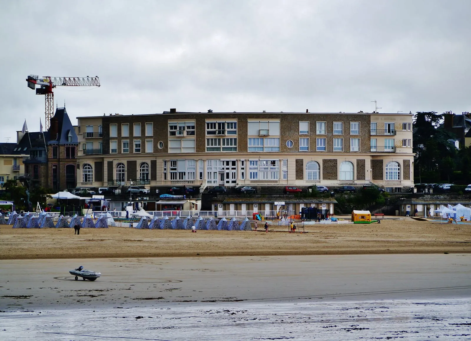
Dinard's central beach, trimmed with its blue-and-white striped tents, between the Pointe du Moulinet and the Pointe de la Malouine. The Belle Époque setting (casino, listed villas, bathing huts) has been the resort's picture for 150 years; Picasso painted here over several summers. The tide makes two beaches of it: a generous low-water expanse of sand for games and long walks, and a high tide that brings the water right up towards the huts. A seawater pool sits at one end, precious when the sea is far out, with lifeguards in summer. Out to sea, the island of Cézembre and, to the right, the ramparts of Saint-Malo.
Garde Guérin headland
Dinard – Saint-Lunaire
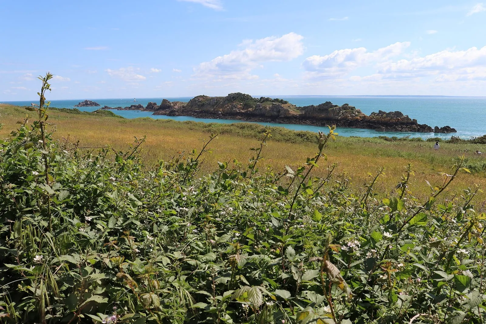
Saint-Briac's great lookout, west of Dinard: a heathland promontory in the care of the coastal conservancy, with a view sweeping the whole Emerald Coast from Cap Fréhel to the ramparts of Saint-Malo. On spring tides you take in the scale of the tidal range at a glance: the Agot and Dame Jouanne islands join the shore at low water, then become islands again within hours. If you do walk out, check the official tide times first and turn back well before the flood. Reached by the coastal path or past the Dinard golf course; in heavy weather, the top of the promontory is the safest post.
Hôtel Printania (Dinard)sea view
Dinard – Saint-Lunaire · €€
Above the Clair de Lune promenade in Dinard, a house of tradition with an unabashedly Breton décor: box beds, faience, regional furniture. The estuary-side rooms hold Saint-Malo in the window: set on the water at high tide, raised above a wide foreshore when the sea withdraws and the Rance uncovers its strands. This is the opposite shore, the one that looks back at the ramparts, with Dinard's sheltered mildness thrown in. The sea-shuttle jetty is five minutes along the promenade: a ten-minute crossing down the estuary, and you step ashore at the foot of the ramparts.
Facing the Ébihens island, Lancieux's main beach unrolls more than a kilometre of west-facing sand. The sunsets, among the finest on the Emerald Coast, are best savoured from the dune when high water arrives at the end of the day. At low water on a big coefficient the sea retreats a very long way, uncovering a vast expanse of firm sand for walking, foraging and kite-flying: the whole landscape changes scale before your eyes. Swimming is best on the rising tide, when the water sweeps back in over the sun-warmed sand and picks up a few welcome degrees.
Longchamp beach (Saint-Lunaire)
Dinard – Saint-Lunaire
The great beach between Dinard and Saint-Lunaire, one of the most extensive on the Emerald Coast, framed by the Pointe du Décollé and the Pointe de la Garde Guérin. Facing north-west, it is the local surf and sea-wading spot when the swell gets in. The tide changes everything here: at low water the sand uncovers for hundreds of metres, room for walkers, sandcastles and great washes of light; then the flood gradually narrows the beach and draws bathers back up the sand. Less urban than the Écluse, more family-friendly than wild, and the coast path leaves from both ends, stretching the day out along the clifftops.
Pointe de la Malouine (Dinard)
Dinard – Saint-Lunaire
Dinard's other point, west of Écluse beach, developed in the Belle Époque with the resort's largest villas: turrets, loggias and English names carved on the gateposts. The path rounding it at rock level looks due north towards Cézembre and the Ébihens: at a spring tide with swell, the breakers frame the villas, and the contrast makes for fine pictures of the Emerald Coast. On such days, watch from a distance and under cover, from the higher ground, never from the sections at water level; check the official tide times before taking the path on a rising tide.
Pointe de la Vicomté (Dinard)
Dinard – Saint-Lunaire
South of Dinard, the Pointe de la Vicomté closes the entrance of the Rance opposite the Alet headland. The coastal path here gives the best overview of the estuary: the tidal power dam upstream, the cove and moorings below, Saint-Malo and the Solidor tower across the water. When the turbines run, you watch the Rance flow like a river, one way and then the other, while the moored boats swing round with the current. Here the level owes as much to the power station as to the moon: a good place to understand this tamed tide, in comfort, from a path set well above the water.
Pointe du Décollé (Saint-Lunaire)
Dinard – Saint-Lunaire
In Saint-Lunaire, ten minutes from Dinard, the Pointe du Décollé juts out as a granite spur above the sea. A stone bridge, the natural bridge of the Décollé, ties it to the shore above a chasm where the swell rushes in noisily at spring tides: enjoy the rumble from the bridge without leaning over, and from a distance in heavy weather. The view takes in the whole Emerald Coast, from Cap Fréhel to Saint-Malo. Access is free; the Sirens' cave below is revealed at low tide. Check the official tide times before climbing down, as the sea reclaims the foot of the rocks quickly.
Pointe du Moulinet (Dinard)
Dinard – Saint-Lunaire
At the entrance to Dinard, this point bristling with Belle Époque villas faces the ramparts of Saint-Malo across the Rance estuary. It is the best place to see the corsair city “set upon the sea” at high water, then ringed with sand at low water. The tidal range reads in a single glance, ideally by catching both ends of the tide. The promenade rounds the point at water level; on rising spring tides, some sections get licked by the waves: check the official tide times before going down, and on days of swell watch from a distance and under cover, from the higher ground of the point.
Cancale – Pointe du Grouin
Cancale oyster beds
Cancale – Pointe du Grouin
As soon as the tide falls, the La Houle foreshore turns into a chessboard: hundreds of oyster beds aligned to the horizon, with tractors and barges working between the trestles. The best moment is low water on a big tide, when the whole grid stands uncovered; take in the show from the jetty or the Hock path, then taste it at the market below the lighthouse, facing the beds. A firm warning: the beds are private workings. You never take anything from them, and you never wander among the trestles, where the mud traps your feet and the flood comes back fast. Check the tide times before any walk out on the foreshore.
Brittany's oyster capital, whose beds grid the foreshore as far as the eye can see whenever the tide falls. It is a farmed landscape drawn entirely by the tide, read at a glance from the quays. At the oyster market by the lighthouse you eat standing up facing the bay, shells returned to the foreshore, with Mont-Saint-Michel as the backdrop. Cancale's flat oyster supplied the table of Louis XIV, who had it carried to Versailles. If the shore tempts you, check the official tide times and head back as soon as the sea rises: the flood comes in fast at the head of the bay.
A wide cove of pale sand backed by its dune, guarded in the middle by the fortified Du Guesclin island, on the coast road to Cancale. The tide reinvents the scenery here twice a day. An undeveloped beach in a protected natural site: no sea wall, no shops, parking is set back from the shore. Lifeguarded in summer on the western side. At low tide you can walk round the island on the sand, without lingering once the sea starts to rise; at high tide the cove becomes a marine amphitheatre again, the island seemingly afloat.
Du Guesclin island
Cancale – Pointe du Grouin
Between Rothéneuf and Cancale, this fortified rock set in the middle of its cove is reached dry-shod at low tide, across the sand. At high water it becomes an island again, best admired from the beach. A castle was held here in the 14th century by the family of Constable Bertrand du Guesclin; the present 18th-century fort was Léo Ferré's home from 1959 to 1968. He wrote several of his songs here. The island is private: no visits, but the walk round the rock and the cove are worth the detour on their own. Watch the rising tide, which closes the crossing: check the tide times before walking out, and turn back as soon as the sea begins to gain.
⚠ low tide only
Hock headland
Cancale – Pointe du Grouin
Cancale's balcony: just above La Houle harbour, the Hock headland overlooks the chessboard of oyster beds and the whole bay of Mont-Saint-Michel, with the Mont in the line of sight on a clear day. It is the best post for following the tide's to-and-fro across the oyster grounds: high water drowns the trestles and hands the scene back to the open sea, low water returns it to sea-farming, ruled in straight lines. The ideal is to frame mid-tide, when the water's movement can almost be watched in real time. The coastal path crosses the point, between the war memorial and the lanes dropping to La Houle harbour.
La Touesse beach (Saint-Coulomb)
Cancale – Pointe du Grouin
Between the Pointe du Meinga and the Du Guesclin cove, a sheltered fine-sand beach, quieter than its Saint-Malo neighbours. This is Colette's shore: from her villa at Rozven, just above, she wrote among others Le Blé en herbe (1923), whose plot plays out on these strands. Coves and rocks at both ends, pools to explore at low tide (the hour of children with shrimping nets), swimming at its best on the flood, and the coast path running along above. The place keeps something of the insouciance of writers' summers, especially off season, when the tide redraws the beach for almost no one.
La Ville Bague malouinière
Cancale – Pointe du Grouin
In Saint-Coulomb, at the heart of the Clos-Poulet, one of the most complete malouinières there is: a main house of 1715, a chapel, a dovecote and walled gardens compose the exact picture of the shipowners' countryside, a league from their counting houses. Far enough from the port to breathe, close enough to keep an eye on business. In summer the guided tour recounts wars and sea fortunes among the furniture and keepsakes of the families who followed one another here, and you leave with a clear sense of how these merchant dynasties lived. Check visiting days and times according to the season.
The spur dividing the Saint-Malo coast from the bay of Mont-Saint-Michel, facing the Île des Landes and its bird reserve. In clear weather the view runs from Cap Fréhel to Mont-Saint-Michel. The start line of the Route du Rhum is laid offshore from here every four years. At spring tides the current accelerates into a genuine tide race between the point and the island, spectacular from the path and feared by sailors. Come at the hours of strongest current for the spectacle, and keep to the marked coastal paths: the cliffs drop straight into the sea.
Cancale's family beach, in the sheltered cove between the Grouin headland and the town: gently shelving sand, a sailing school, cafés at the water's edge and a view of Rimains island and its fort. The tide sets the rhythm of the day here: at low water the cove uncovers widely and the dinghies sit on the sand waiting for the flood; on the rising tide the water sweeps back over sun-warmed sand, the best moment for a swim. It is also a good starting point for the coastal footpath towards the Grouin: allow a short hour's walk along the clifftops, facing the open sea.
Rimains island
Cancale – Pointe du Grouin
Set before Cancale, Rimains island carries a late-18th-century fort, built to plans in the Vauban tradition to lock the bay against the English. The island is private and cannot be visited, yet with the oyster beds it forms the foreground of almost every view of Cancale. The picture changes with the tide: at low water it seems to float on the uncovered oyster trestles; at high water it becomes fully an island again. The finest moment is still sunrise over the bay, from the Épi slipway or the path towards Port-Mer. Admire it from the shore, without wandering out across the foreshore towards the island.
Verger cove
Cancale – Pointe du Grouin
Between the Grouin and Nid headlands, the Verger cove is Cancale's great wild beach: an arc of sand backed by protected dunes, with no sea wall or seafront, watched over by the Notre-Dame du Verger chapel where the Newfoundland fishermen came to pray before each campaign. North-facing, it takes the swell of every blow. Fine to watch at high water, but a beach to swim from with care at all times. At low tide the foreshore stretches from one headland to the other below the coastal path: the hour for long walks on firm sand, in raking light. You come here for space, not for facilities.
Cap Fréhel
Cap Fréhel
Cap Fréhel
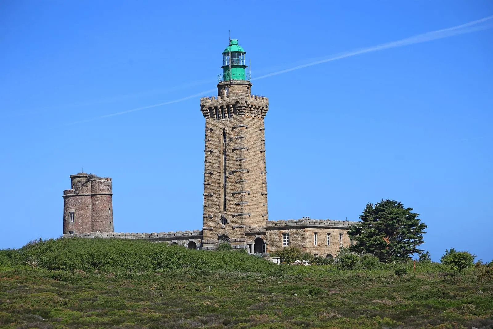
Some forty kilometres to the west, Cap Fréhel's cliffs of pink sandstone and black schist drop seventy metres into a turquoise sea. The protected heath of heather and gorse blazes with colour in spring and late summer; seabird colonies nest on the sheer faces, at one of the great birdwatching sites of the Channel coast. The lighthouse can be climbed in season, and from the top the eye carries far over a sea the tide keeps animating at the foot of the cliffs. Allow half a day including the coast road, and keep to the paths: the wind and the drops are unforgiving.
The castle of La Roche Goyon, a 14th-century fortress planted on a headland next to Fréhel, is reached by two drawbridges thrown over chasms where the sea beats. At high tide, with a swell running, the roar climbs to the curtain walls. Remodelled under Louis XIV for artillery, it keeps its shot furnace, used to heat cannonballs red-hot and set ships ablaze. Cinema has passed through too: the final duel of The Vikings, with Kirk Douglas, was filmed here in 1957. From the wall-walk, a plunging view over the whole Fresnaye bay. Allow for a stretch of approach walk to reach the gates.
The small islet in the middle of the Rance, just upstream of the tidal power station's dam, topped since 1897 by a statue of the Virgin facing the open sea. It is the water-level marker of the Rance: depending on the plant's releases, its base is left dry or almost entirely covered, a stone gauge you quickly learn to read. Watch it from the dam, the Alet headland or the Corbières park, each offering a different angle on the estuary. A useful reminder: upstream of the dam the 'tide' is driven by the power station. SHOM tide times do not apply there, and the level can change at any hour.
Cancaval headland
Rance valley
On the Pleurtuit bank, opposite Quelmer, the Cancaval headland juts out as a wooded spur above the broad basin of the Rance. From the path the view runs from the dam to Saint-Suliac: a good place to watch the river's shifting levels, as mudflats and banks uncover and vanish to the rhythm of the tidal power station. Here the water does not follow the natural tide table, and the scenery can change within the hour. Below, the Montmarin manor and its gardens step down to the water. Reached on foot from Jouvente along the coastal path; keep to the path, as the uncovered shores are treacherous.
Châtelier lock and Lyvet port
Rance valley
This is where the sea ends. The Châtelier lock marks the limit of the maritime Rance: downstream, the estuary and its tide; upstream, the placid canal leading to Dinan. Lockages only happen when the water is high enough, around high tide, and the little port of Lyvet lives to that rhythm, between waiting yachts and square-net fishermen. Arrive around high water to watch the ballet of boats; at low tide the ria is nothing but channels and mudflats. From the bridge you take in the contrast of the two worlds; crêperies and a slipway on site. A perfect destination along the Rance cycleway.
Dinan
Rance valley
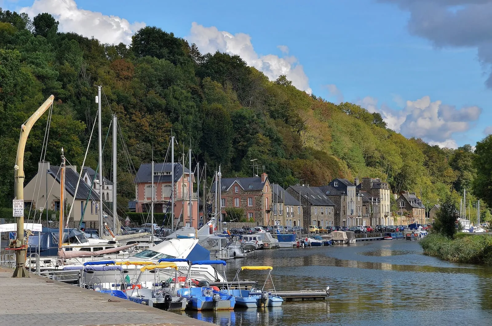
Thirty kilometres upstream, Dinan is Brittany's most complete medieval town: nearly three kilometres of ramparts, whole streets of timber-framed houses, and the vertiginous Rue du Jerzual tumbling down to the port. The tide stops just downstream: the Rance is tidal up to the Châtelier lock, and above it the canalised river leads on to the little port below the town. Cruising up the Rance by boat from Saint-Malo, along an estuary the tide endlessly redraws, is the finest way to arrive; allow a full day to wander between port and ramparts.
On the left bank of the Rance, the Landriais cove was one of the estuary's great shipyards: Newfoundland schooners and coasters were built here in wood, and the 19th-century dry dock, known as the “cale de l'Épine”, can still be read in the foreshore. It shows best at low tide, keeping an eye on the flood, which returns quickly in the ria. The path along the bank strings together mossy slipways, bird-filled mudflats and stone villages: the painters' Rance, twenty minutes from Saint-Malo. A few yards here keep traditional wooden boatbuilding alive.
The only malouinière built on the left bank of the Rance, at Pleurtuit: raised in the 18th century for a shipowner who added a shipyard and a slipway on the estuary, proof that these country houses stayed turned towards the sea and its business. Its terraced gardens, listed as a “remarkable garden”, step down to the water, mixing French parterres with a scented garden; from the terraces you can follow the tide's comings and goings on the estuary. The place sums up what the maritime Rance was: Saint-Malo's second seafront, lined with residences and slipways. Open to visitors in season; check the hours.
One of the finest spots on the maritime Rance, halfway between Saint-Malo and the Châtelier lock. It is also one of the best places to grasp what the tide does to the estuary. At high tide the slipway dips into a tranquil lake; at low tide the estuary all but withdraws, uncovering mudflats, salt meadows and the hulks of old boats lying on their sides, a landscape at once Norman and Breton dominated by the ruins of Péhou castle. A café-guinguette on the slipway in season. The spectacle of the refilling, on the flood, is worth lingering an hour for; the mudflats themselves, though, are no place to wander: the mud is unforgiving.
Plouër-sur-Rance
Rance valley
Mid-estuary, on the left bank, Plouër hides its marina in a former mill cove: a sill holds the water back at low tide, so its boats float while the rest of the Rance lies dry, a direct legacy of the tide-mill dykes. The contrast is most striking at dead low water, when the brimming basin overlooks the emptied ria. Around it, granite hamlets, old slipways and a bankside path towards the Plouër slipway and Langrolay. A peaceful stage on the way up to Dinan, twenty-five minutes from Saint-Malo, ideal for a quiet walk far from the crowds on the ramparts.
The maritime Rance once counted more than a dozen tide mills: a dyke closes off a cove, the sea fills it on the flood, and the water released on the ebb turns the wheel. It is the same principle as the tidal power station, five centuries early. The Prat mill, attested from the 15th century, was rescued and restored to working order by an association; in summer, visits and demonstrations show the machinery at work, to a timetable set by the tide itself. All around, the adjoining cove, its salt meadows and its path sum up the Rance as it was before the dam. Come on a rising or falling tide to watch the water move.
Visits and demonstrations in summer; check the dates.
Near the dam, the Rance no longer obeys the moon alone: the power station's turbine runs and sluicings create violent currents and shift the estuary's level out of step with the natural tide. A peaceful foreshore can thus be covered in minutes, with no wind or swell to give warning. Swimming and boating are forbidden in the dam's safety zone, and on every Rance shore one rule applies: the water can rise earlier and faster than the tide table announces. Leave no gear and no children at the water's edge on the slipways, and keep a constant eye on the level.
Commissioned in 1966, the world's first industrial-scale tidal power station: its 24 turbines generate electricity in both directions, on the flood and on the ebb. The exceptional tidal range of the Rance has been turned into energy for sixty years. Nowhere else on this coast does the local tide show itself so concretely as a working force. The dam carries the road linking Saint-Malo to Dinard, with a lock for boats. The visitor centre on the right bank explains how it all works; check that it is open before making the detour.
On the left bank of the Rance, one of the officially listed Most Beautiful Villages of France: fishermen's lanes lined with low walls where nets still sometimes dry, a fortified church within its close, gentle slipways on the estuary. A former Newfoundland-fishing village, whose women watched for the return of the cod schooners. From neighbouring Mont Garrot the view takes in the whole valley; at low tide the ria uncovers banks and old fish traps, a landscape reinvented twice a day. If you step down onto the foreshore, keep an eye on the time: the sea comes back quickly in the estuary.
At Genêts, on the Norman side, the Bec d'Andaine headland is the great departure point for crossing the bay on foot to Mont-Saint-Michel. That is around thirteen kilometres there and back across the flats, among channels, quicksands and a flood tide that returns at walking pace. Here the tide is not scenery but the rule of the game: the crossing is only ever made with a certified guide, who times the outward and return legs by the day's tide. Never set out onto these flats alone, even in fine weather, and be back on the shore well before the flood returns. Even without crossing, the view of the Mont from the dune is worth the trip in itself.
The sand-yachting village: when the sea withdraws to the head of the bay, it leaves Cherrueix a vast table of hard sand where the yachts run with the wind abeam, with resident schools and clubs. The seafront lines up its low houses against a horizon where Mont-Saint-Michel floats like a mirage. The whole activity is governed by the tide: sessions are set around low water. Book after checking the official times for the day. And on these immense sands one rule holds for everyone: head back to the dyke as soon as the sea rises, and only venture far out with a certified guide.
Saint-Samson's cathedral, a Gothic vessel of granite at the gates of the marsh, recalls that Dol was one of Brittany's great religious seats. It was a port too, in the days when the sea reached the foot of the town, before it withdrew from the marshland. Its north front, austere as a fortress, once looked towards the shore; walk right around it to take the measure of a maritime past that has become a landscape of land won from the sea. Around it, the old town keeps its medieval arcaded houses, made for unhurried wandering. An ideal stop to pair with nearby Mont-Dol on the road to Mont-Saint-Michel.
On the Vains shore, this low headland juts into the bay opposite the mouths of the Sée and Sélune rivers: one of the best posts for watching the tidal bore, the wave that runs upriver at the head of the flood on big-coefficient days. Regulars arrive a good hour before the high water announced for Granville. Check the official tide times for the day before setting out. From the point you also overlook the comings and goings of the guided crossings, and see how fast this bay fills: stay on the headland itself, never on the flats once the tide has turned.
Between Le Vivier and Château-Richeux, the little road along the bay's sea dyke threads through Hirel and its fishing hamlets: the Dol marsh on one side, on the other the endless foreshore worked by mussel farmers and shore foragers. It is the route to choose between the bay and Cancale. At high water the sea touches the dyke; at low water it vanishes over the horizon and the landscape changes scale. A few slipways invite you to stop and take the measure of the tidal range. If the foreshore tempts you, be careful: check official tide times, turn back as soon as the sea rises, and take a certified guide before venturing onto the bay's sands.
Le Vivier-sur-Mer and its mussel beds
Bay of Mont-Saint-Michel
The capital of the bouchot mussel: rows of stakes planted across miles of foreshore, uncovered as far as the eye can see at low water. The scenery transforms completely between high and low tide, and the ebb is when the show is at its most striking. The mussel farmers reach their bouchots in amphibious boats that sit straight on the sand, a ballet easily watched from the sea dyke. The bouchots are private workings: admire them from a distance or join one of the organised outings from the harbour, and never wander out onto these flats alone. This bay does not forgive improvisation.
Mont-Saint-Michel's landlocked brother: a granite dome in the middle of the Dol marsh, a former island abandoned by the sea when the land was dyked. From the top (windmill, chapel and orientation table), the view takes in the whole bay, from the Grouin headland to the Mont, and reads the shoreline's history at a glance: the marsh was once foreshore. It is also the most serene observatory of the great tides, far enough from the water to see everything and risk nothing: the shining sheet of high water, then the immense uncovered sands. Legend sets the fight between Saint Michael and the devil here, and the rock is said to keep the claw marks.
Mont-Saint-Michel
Bay of Mont-Saint-Michel
An hour's drive from Saint-Malo, the bay where spring tides take on their legendary dimension: the sea withdraws more than ten kilometres and returns, as the saying goes, “at the speed of a galloping horse”. In truth it is that of a fast walker, quite enough to trap people among the sands and channels. On the strongest coefficients the Mont becomes an island again before the eyes of the crowds massed on the ramparts, a spectacle to time with the official tide tables. Never wander onto the flats alone: cross the bay on foot only with a certified guide, and turn back as soon as the sea rises.
The sands of this bay are the most dangerous ground on the whole coast: invisible quicksands, channels that shift from one tide to the next, fog that erases every landmark within minutes, and a flood tide that returns at walking pace, encircling the banks from behind. The danger gives no warning: the flats look vast and still at the very moment the sea is taking them back. Never venture beyond the immediate shore alone: crossings are made exclusively with a certified guide, timed to the day's tide. Check the official tide times before any approach to the foreshore, and turn back without hesitation if fog comes in.
The nicest way is the sea bus: a ten-minute crossing between the Dinan slipway (Intra-Muros) and Dinard, from late March to early November; it does not run in winter. By car, allow twenty-five minutes via the Rance dam. In Dinard, the Clair de Lune promenade and the Pointe du Moulinet look Saint-Malo straight in the face.
Where should you eat oysters in Cancale?
At the oyster market on the Épi slipway, facing the beds: a few euros a dozen, eaten on the jetty, shells returned to the sea. The oyster beds dry out at low tide. On the big coefficients, the oyster tractors head out onto the foreshore. The Pointe du Grouin is ten minutes away.
Can you see Mont-Saint-Michel from Saint-Malo?
On a clear day you can make it out from the Pointe du Grouin or Rothéneuf. For a visit, allow an hour's drive; on the big tides, the Mont becomes an island again for the duration of high water, which you plan with the same coefficients as at Saint-Malo. Our dedicated page covers the journey and the right tide time.
Do you need a car to explore around Saint-Malo?
Not for everything: Dinard is a sea-bus ride from the walled city, and regional BreizhGo coaches serve Cancale, Dol and the coast from Saint-Malo station. Check the timetables, which vary by season. A car remains the simplest option for Cap Fréhel, the malouinières and the Rance valley, where the villages lie far from the bus lines.
Which day trip should you pick on a spring tide?
At high water: Cap Fréhel and the headlands for swell against the cliffs, or Dinard to watch Saint-Malo ringed by the sea. At low water: Cancale and its uncovered oyster beds, the shoreline road around the bay of Mont-Saint-Michel, or sand yachting at Cherrueix. The Rance, for its part, follows the tidal power station rather than the moon: an outing for any hour of the day.

_-_01.jpg)
.jpg)
_-_La_Rance_-_Le_port_de_Dinan-Lanvallay_(50519407177).jpg)