High water makes the show, but low water makes the playground. Twice a day the sea hands Saint-Malo back square kilometres of foreshore: causeways open to the islets, the beaches triple in size, the rocks turn into a larder. This page gathers everything low tide makes possible, and the list of places you can only visit at that moment.
Islands dry-shod
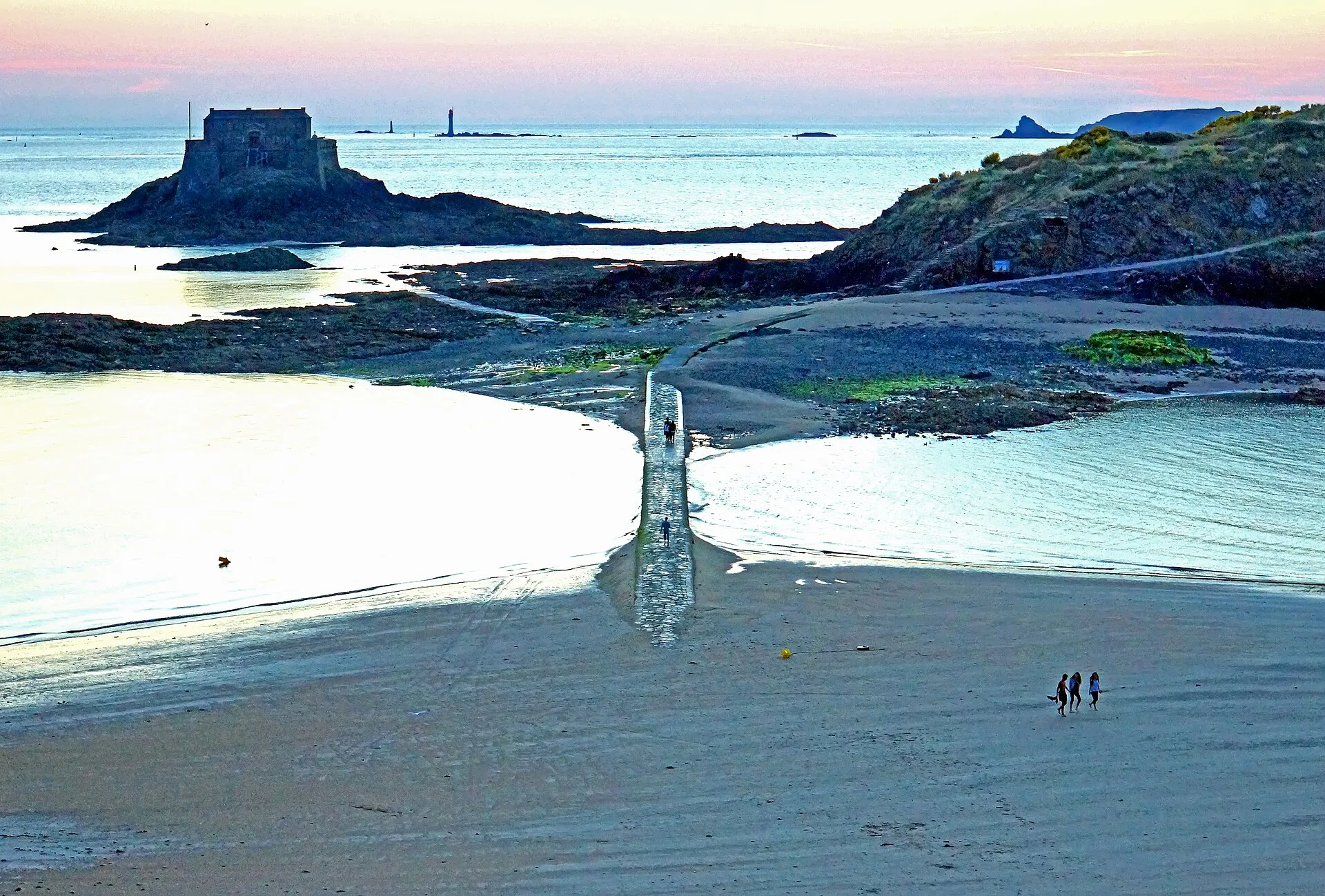
The great classic: from Bon-Secours, the uncovered causeway leads to the Grand Bé and Chateaubriand’s tomb, then on to the Petit Bé and its fort; from the Éventail beach you reach Fort National. Crossings of only a few hundred metres, but the sea closes them again with every rising tide. Our page on the tidal islands details the crossing window and the times to check.
On the biggest coefficients, low water presses the advantage further: the full circuit of the Grand Bé can be walked dry, the Petit Bé causeway emerges from end to end, and the cove between the islets becomes a sand esplanade you cross in a straight line. On those days the window is wider, but the return of the sea is faster too: the rule about heading back does not change.
The foreshore, a temporary country
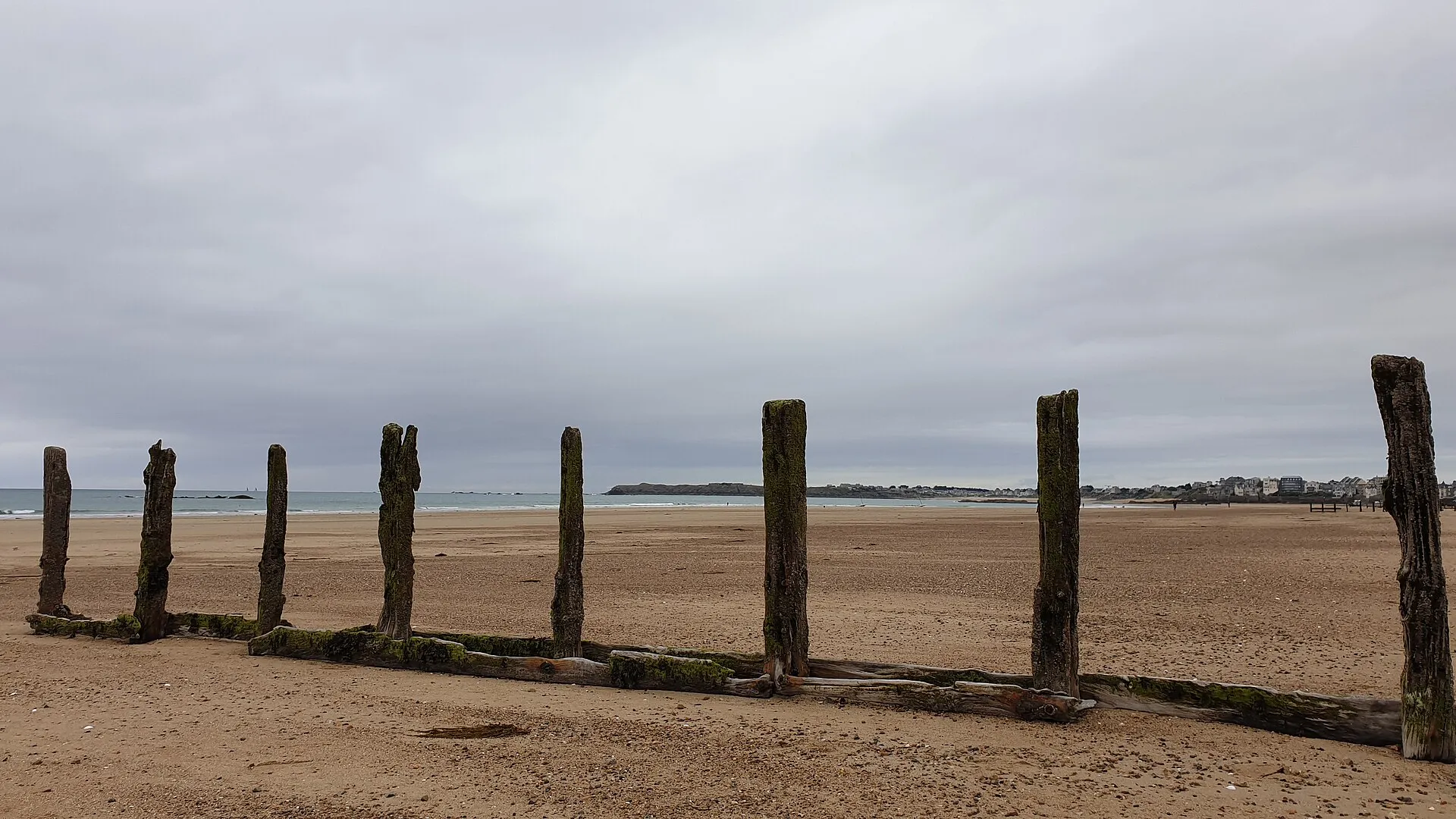
On big coefficients the sea retreats several hundred metres: the Sillon becomes a desert of firm sand where you walk at the foot of the breakwaters, the cove between the two Bés turns into a plain, and over at Rothéneuf the tidal basin empties almost completely. This is the time for outsized sandcastles, warm rock-pool paddling, walks to rocks that haven’t seen a visitor since the last spring tide, and for shellfish foraging, which has a page of its own.
It is also the photographers’ hour: breakwaters lined up to the horizon, reflections in the wet sand, forts sitting on the sands like stranded ships. The low morning and evening light does the rest, and the wet foreshore holds every silhouette in its mirror.
Swimming when the sea has gone
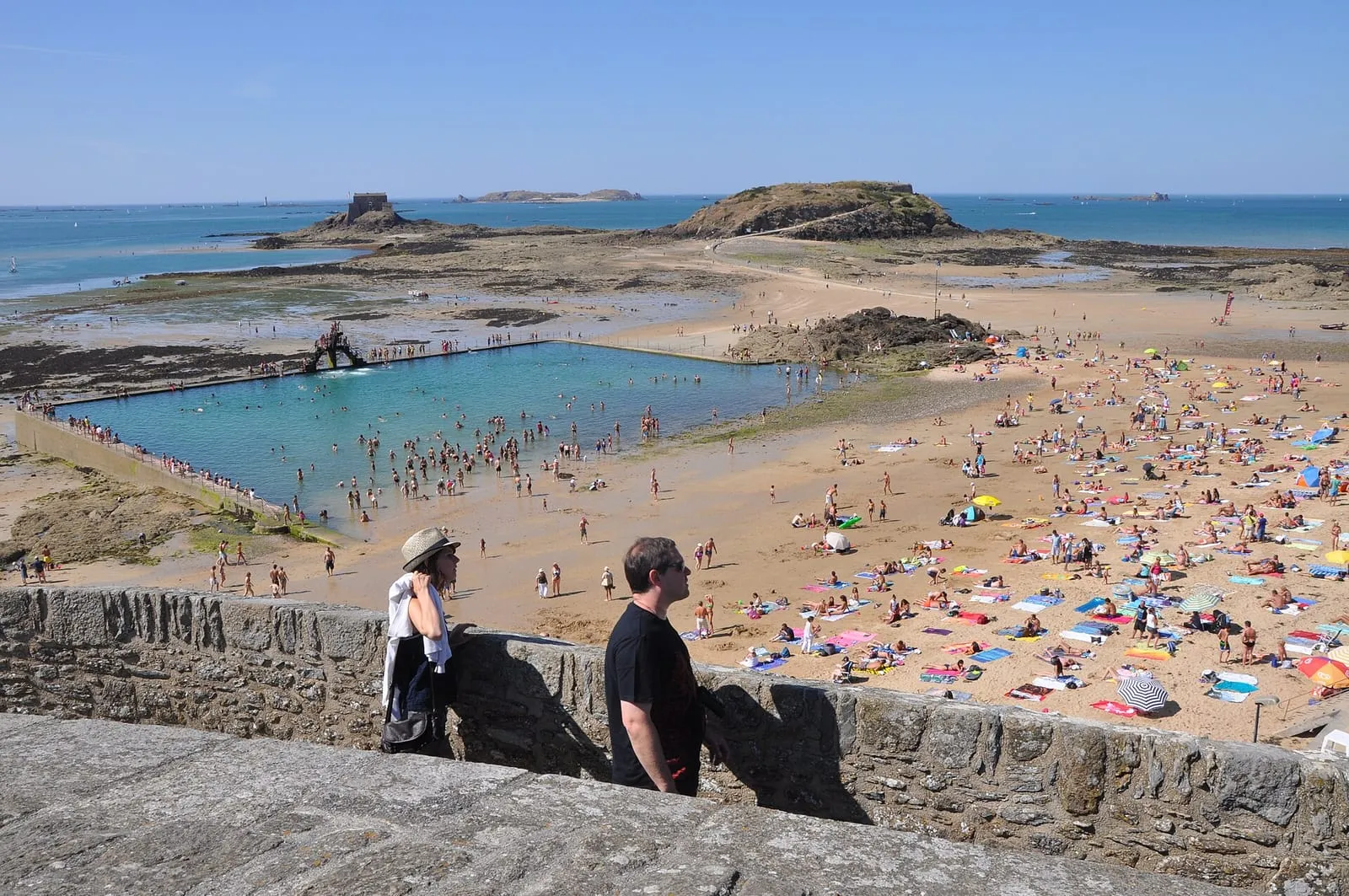
Two schools. The Bon-Secours pool, refilled at every high water, keeps its water when everything else has drained away: that has been its whole purpose since the 1930s, diving platform included. Or the walk out to the water, long on big coefficients but rewarded by a sea gentled by the sandbanks, often warmer for having crossed the sun-heated flats. In season, stay within the lifeguarded bathing zones, and on the way back beware of the channels, which fill first.
With children
Low tide is the best playground in town: warm pools to explore, crabs under the stones (laid back the right way up, always), sandcastles on the scale of the tidal range, and the crossing to Fort National as a full expedition. Two habits to hand down from the very first outing: look up and place the sea every ten minutes, and head back the moment the water changes direction. Distances deceive on the foreshore: a child absorbed in a rock pool does not see the sea returning behind them.
The golden rule: out on the ebb, back at the turn
Everything low water opens, the flood closes again. In this bay the sea advances at walking pace, filling in from the sides rather than head-on. The local rule fits in one sentence: go out while the sea is falling, head back as soon as it turns. Before any outing, check the time of low water against the official SHOM tide times, keep a margin on the turn, and never cross to an islet on a rising tide. The spring tide calendar tells you on which days the foreshore will give its very best.
⚠ Places marked “low tide only” can only be reached at low tide: check the official SHOM tide times before crossing. Official tide times (SHOM) ↗
Intra-Muros
Bon-Secours sea pool
Intra-Muros
Saint-Malo's answer to low tide: when the sea retreats several hundred metres, this 1930s granite basin keeps its water, refilled and renewed at every high tide. Its three-tier diving board has become one of the town's emblems, often photographed at sunset. You can swim at any state of the tide, which is precisely what it was built for: while the sand lies bare as far as the eye can see, the swimming carries on here. But there is no lifeguard off season, and the bottom stays slippery with seaweed near the steps: take care with children.
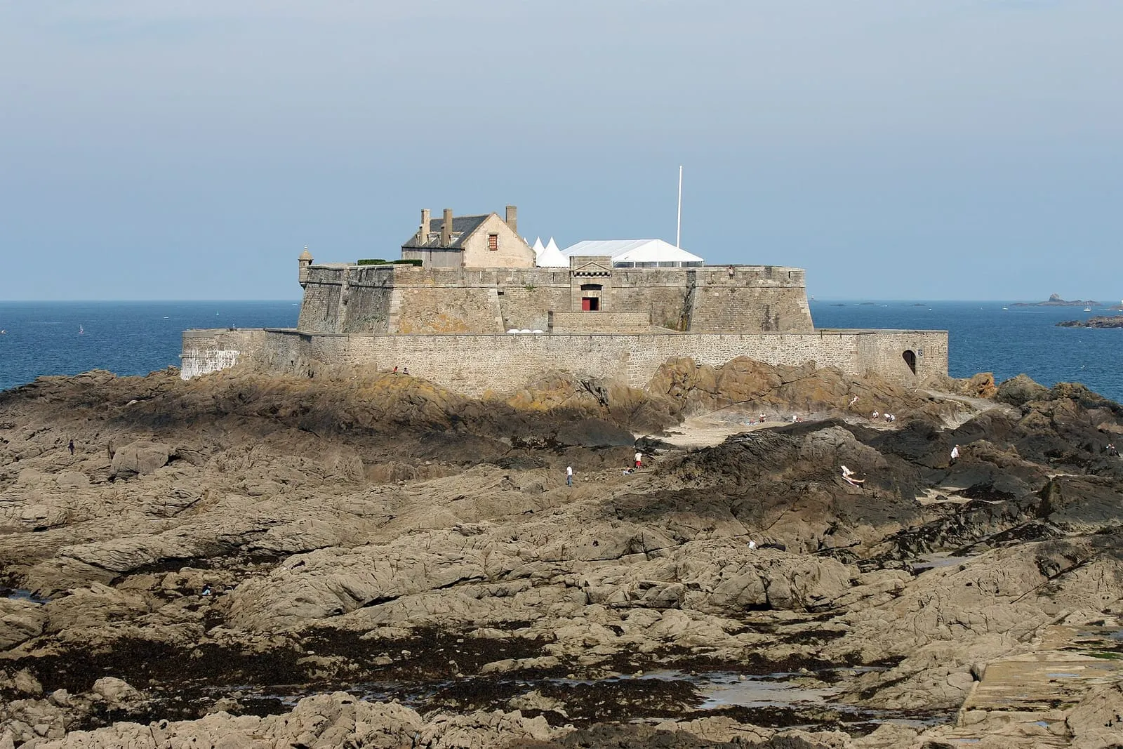
On its rock facing Éventail beach, this fort designed by Vauban in 1689 and built by Garangeau in Chausey granite guarded the roadstead together with the Petit Bé and La Conchée. You walk out to it dry-shod at low tide; the flag flying means the guided tour is open, in season. From the rampart walk, an unbeatable view over the Sillon and the city walls: depending on the hour of the tide, sea on every side or an immense desert of sand. At the biggest coefficients the sea uncovers the crossing generously, then closes it again in under an hour: check the tide times before walking out, and don't wait for the first pools to head back.
Visits at low tide, roughly Easter to late September. The flag is flown when the fort is open.
The islet where Chateaubriand chose to be buried so he could “converse only with the sea”: his grave, a nameless slab topped with a cross, has faced the open water since 1848. You reach it dry-shod from Bon-Secours beach along a causeway the sea uncovers around mid-tide: a fine moment to climb up and catch the evening light over the bay. Walking round the islet gives the finest close-up view of the ramparts. But the sea cuts the Grand Bé off for several hours at every tide: check the official tide times before crossing and head back as soon as the flood reaches the causeway. Rescuing stranded walkers is a local classic.
Behind the Grand Bé, this second islet carries a fort designed by Vauban at the end of the 17th century, one link in the ring of fire that locked the roadstead together with Fort National and La Conchée. A volunteer association is restoring it and opens it for visits depending on tide and season, a rare chance to see the roadstead from one of its locks. The crossing continues from the Grand Bé along a second causeway, which low water uncovers for less time than the first: the window is shorter, so the vigilance must be greater. Check the official tide times before setting out, and head back without delay as soon as the sea starts to rise.
At Quelmer, the old slipway from which the ferryman crossed the Rance to Jouvente before the dam was built. Today it is a peaceful end-of-the-road spot, perfect for a stroll away from the crowds: fishing huts on stilts, oyster beds, wide foreshores uncovered whenever the tidal power station lowers the water level, and soft late-day light on the estuary. One Rance peculiarity to respect: levels here rise and fall to the rhythm of the turbines, not the SHOM tide tables. A dry stretch of foreshore can flood again with no tide 'due'. Keep an eye on the water whenever you step down off the slipway.
Paramé – Rochebonne
Rochebonne foreshore – shore foraging
Paramé – Rochebonne
At spring tides, the foreshore uncovered between Rochebonne and the Minihic becomes shore-foraging country: cockles and clams in the sand, winkles and shrimp in the rock pools. The right window falls around low water, in the hours either side of it, when the sea uncovers most widely. Respect the minimum sizes and quantity limits, and check the current health advisories before gathering anything. The local golden rule: read the official tide times, walk out as the sea falls, turn back at slack water. The flood comes back in here at walking pace, faster than you think.
North of the Rothéneuf inlet, the wild sweep of Chevrets beach backs onto dunes between Besnard island and the Pointe du Meinga. The island is reached along a sand spit, and the path around it strings together coves and viewpoints over the open sea. An ideal loop at low water, when the sand carries you everywhere. The inlet itself all but empties at low tide: a landscape of sand and channels that changes by the hour, before the flood fills it again. Few facilities and a lot of space: the counterpoint to the urban beaches of the Sillon. Keep an eye on the rising tide if you wander out across the banks.
La Guimorais foreshore
Rothéneuf
Between the Meinga headland and Les Chevrets, the Guimorais foreshore borders the Rothéneuf tidal basin, which empties almost completely at low water: firm sand, pools, shellfish beds. It is one of the busiest shore-foraging grounds on spring tides, and a fine walk in any season once the sea has withdrawn, in a landscape that changes hour by hour. But the basin refills through a narrow channel and the sea comes back far faster than it left: check the official SHOM tide times before going down onto the flats, and start back as soon as the tide turns, without waiting to see the water arrive.
As soon as the tide falls, the La Houle foreshore turns into a chessboard: hundreds of oyster beds aligned to the horizon, with tractors and barges working between the trestles. The best moment is low water on a big tide, when the whole grid stands uncovered; take in the show from the jetty or the Hock path, then taste it at the market below the lighthouse, facing the beds. A firm warning: the beds are private workings. You never take anything from them, and you never wander among the trestles, where the mud traps your feet and the flood comes back fast. Check the tide times before any walk out on the foreshore.
Between Rothéneuf and Cancale, this fortified rock set in the middle of its cove is reached dry-shod at low tide, across the sand. At high water it becomes an island again, best admired from the beach. A castle was held here in the 14th century by the family of Constable Bertrand du Guesclin; the present 18th-century fort was Léo Ferré's home from 1959 to 1968. He wrote several of his songs here. The island is private: no visits, but the walk round the rock and the cove are worth the detour on their own. Watch the rising tide, which closes the crossing: check the tide times before walking out, and turn back as soon as the sea begins to gain.
⚠ low tide only
Rance valley
Mordreuc slipway (Pleudihen-sur-Rance)
Rance valley
One of the finest spots on the maritime Rance, halfway between Saint-Malo and the Châtelier lock. It is also one of the best places to grasp what the tide does to the estuary. At high tide the slipway dips into a tranquil lake; at low tide the estuary all but withdraws, uncovering mudflats, salt meadows and the hulks of old boats lying on their sides, a landscape at once Norman and Breton dominated by the ruins of Péhou castle. A café-guinguette on the slipway in season. The spectacle of the refilling, on the flood, is worth lingering an hour for; the mudflats themselves, though, are no place to wander: the mud is unforgiving.
Bay of Mont-Saint-Michel
Bec d'Andaine: bay crossing departures
Bay of Mont-Saint-Michel
At Genêts, on the Norman side, the Bec d'Andaine headland is the great departure point for crossing the bay on foot to Mont-Saint-Michel. That is around thirteen kilometres there and back across the flats, among channels, quicksands and a flood tide that returns at walking pace. Here the tide is not scenery but the rule of the game: the crossing is only ever made with a certified guide, who times the outward and return legs by the day's tide. Never set out onto these flats alone, even in fine weather, and be back on the shore well before the flood returns. Even without crossing, the view of the Mont from the dune is worth the trip in itself.
The capital of the bouchot mussel: rows of stakes planted across miles of foreshore, uncovered as far as the eye can see at low water. The scenery transforms completely between high and low tide, and the ebb is when the show is at its most striking. The mussel farmers reach their bouchots in amphibious boats that sit straight on the sand, a ballet easily watched from the sea dyke. The bouchots are private workings: admire them from a distance or join one of the organised outings from the harbour, and never wander out onto these flats alone. This bay does not forgive improvisation.
What is there to do in Saint-Malo when the tide is out?
Walk across to the Grand Bé or Fort National, stride out on the suddenly immense Sillon sands, swim in the Bon-Secours pool which keeps its water, hunt cockles and clams on the spring tides, or follow the rocks towards Rothéneuf. Every place in the list below has its own entry, with what low water uncovers there.
Can you swim at low tide in Saint-Malo?
Yes, two options: the Bon-Secours seawater pool, refilled at every high water, which keeps its swim when the sea has gone (that is what it was built for), or the walk out to the water, long on big coefficients but rewarded by a sea calmed by the sandbanks. Stay within the lifeguarded zones in season, and watch the channels on the way back.
How long can you stay out on the foreshore?
The golden rule in Saint-Malo: go out on the falling tide, turn back the moment it turns. The sea stays low for about two hours, then rises for six. In this bay it advances at walking pace. Check the official SHOM tide times before you set out, and start back as soon as the time of low water has passed.
How far out does the sea go in Saint-Malo?
With a tidal range reaching 12 to 13 metres on the biggest coefficients, the sea can retreat several hundred metres from the top of the beaches. On spring tides the Sillon foreshore becomes a desert of firm sand, normally submerged rocks and beds uncover, and causeways appear towards islets that are unreachable the rest of the time.
Is low tide better during a spring tide?
Yes: the higher the coefficient, the lower the sea drops and the wider the uncovered foreshore. From a coefficient of about 90, zones that rarely see the air appear: this is the moment for shore foragers and long walks across the sands. The dates of the next big coefficients are shown on this page and in the calendar.


.jpg)
,_swimming_pool_on_beach.JPG)