Fort la Latte: La Roche Goyon castle above the sea
Updated on 31 July 2026
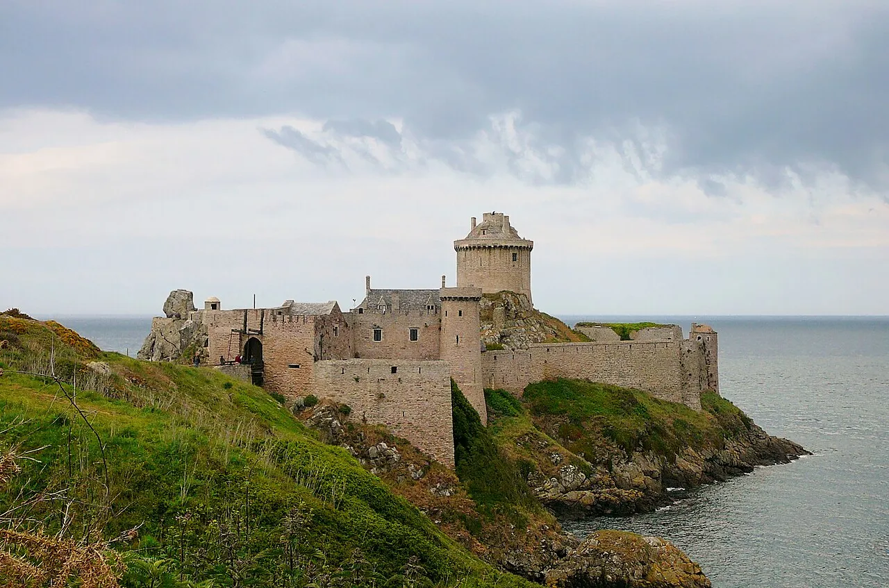

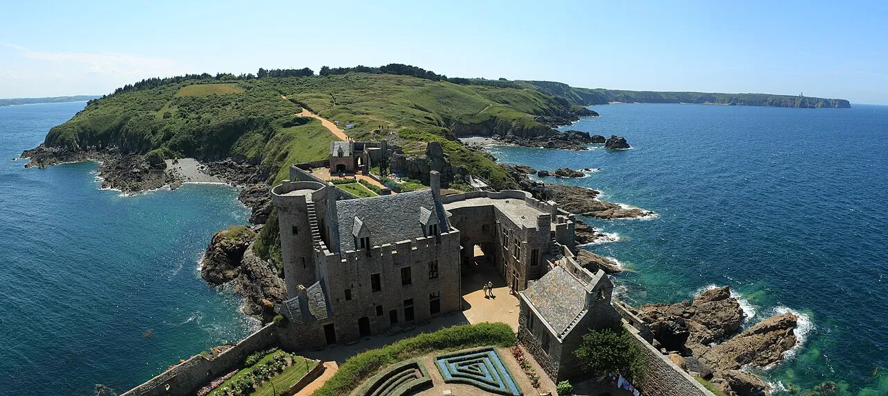
Known by its true name as La Roche Goyon castle, Fort la Latte is a 14th-century fortress gripping a rocky spur above the sea, at the western end of the Emerald Coast. To enter, you cross two moats on drawbridges. That is the setting: a keep set on its rock, open sea on three sides, and the mainland attached only by the tips of the bridges. Among the excursions around Saint-Malo, few places make so immediate an impression.
From medieval castle to artillery fortress
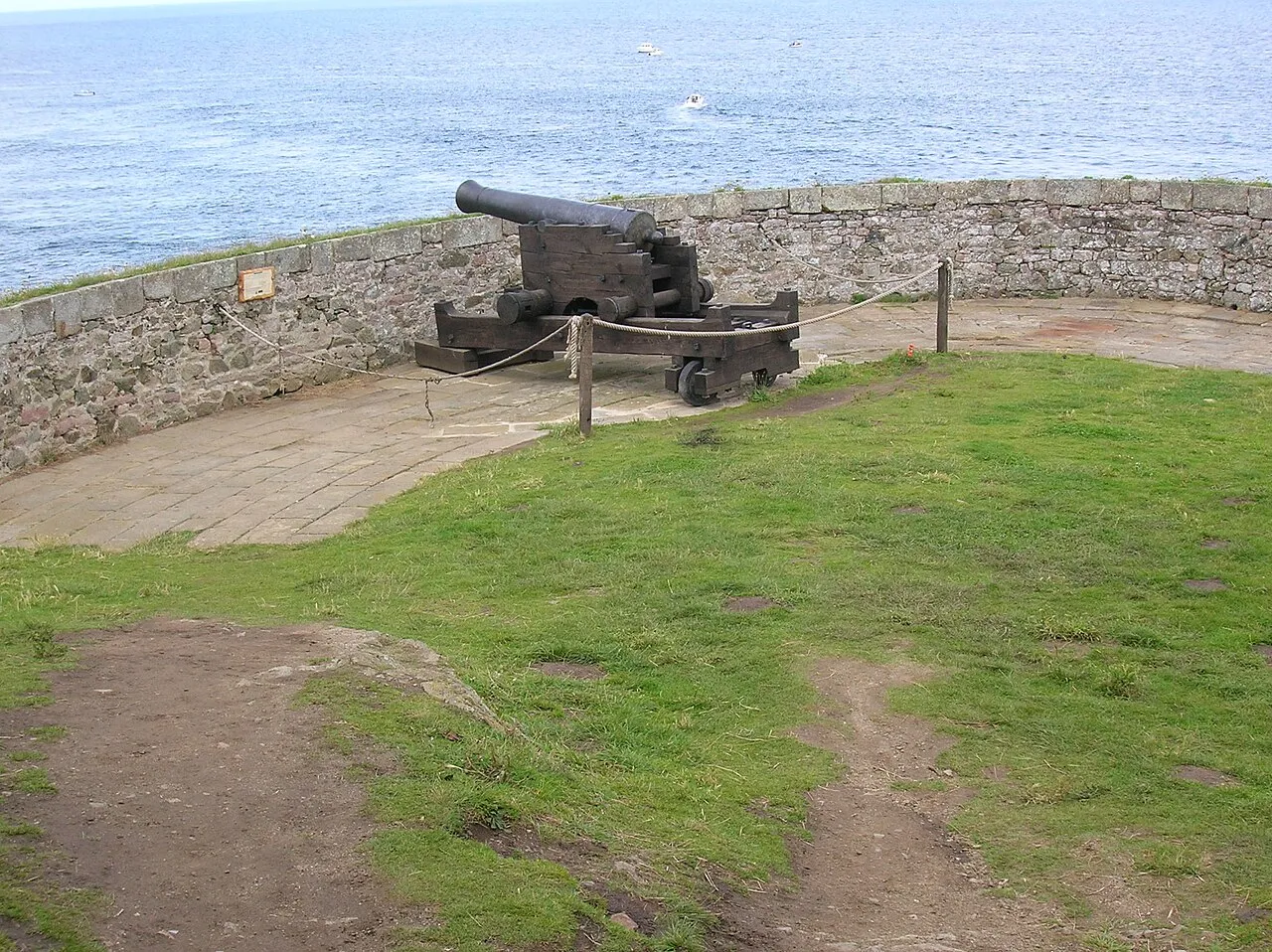
Born a castle in the 14th century, the place changed eras without ever changing rock: refitted for artillery, it gained cannons and a red-hot shot oven, a furnace for heating cannonballs to glowing red before firing them at wooden hulls. Left to time and then restored in the early 20th century, it recovered the full silhouette of a working fortress: moats, drawbridges, ramparts, keep. The visit unfolds that history stone by stone, with the sea as a backdrop throughout. The fort is a medieval cousin of the roadstead forts described in the heritage pages.
A visit (and a film set)
The fort is privately owned and open to visitors; check opening times and prices on the official website before you come. La Roche Goyon has served as a film location, most famously for “The Vikings” (1957), and you understand why at the first drawbridge. From the ramparts, the view sweeps over the Baie de la Fresnaye and the Emerald Coast; below, the sea keeps working at the spur, and in heavy weather the confrontation between swell and rock is a reminder of who, granite or water, has the last word.
Along the GR34 from Cap Fréhel
The finest approach to the fort is not by car but on foot: the GR34 links it to Cap Fréhel by about four kilometres of coastal path: cliffs, moorland, coves, and the fort revealing itself from afar on its spur. The out-and-back makes a half-day walk, best timed for morning or evening light.
Take care on the path: it runs along unfenced drops, and the wind often blows hard on this stretch of coast. Stay on the waymarked route, keep children close, and let the laid-out viewpoints frame your photographs. The fort, its exact position and the neighbouring places are on the interactive map.
Written and kept up to date by a Saint-Malo local in love with this coast. The story behind this guide


Why is Fort la Latte also called La Roche Goyon castle?
Because that is its real name: this 14th-century castle stands on a rocky spur facing the sea, cut off from the mainland by two moats crossed on drawbridges. "Fort la Latte" is the name that stuck in everyday use, but La Roche Goyon remains its original identity.
Can you visit Fort la Latte?
Yes: the fort is privately owned and open to visitors. Check opening times and prices on the official website before you come, as slots vary with the season and the crowds.
How do you reach Fort la Latte from Cap Fréhel?
Along the GR34: about four kilometres of coastal path link the cape to the fort. Take care on the way: the path runs along unfenced drops and the wind can be strong. Stay on the waymarked route.