The Pointe du Grouin: between Mont-Saint-Michel bay and the Emerald Coast
Updated on 31 July 2026
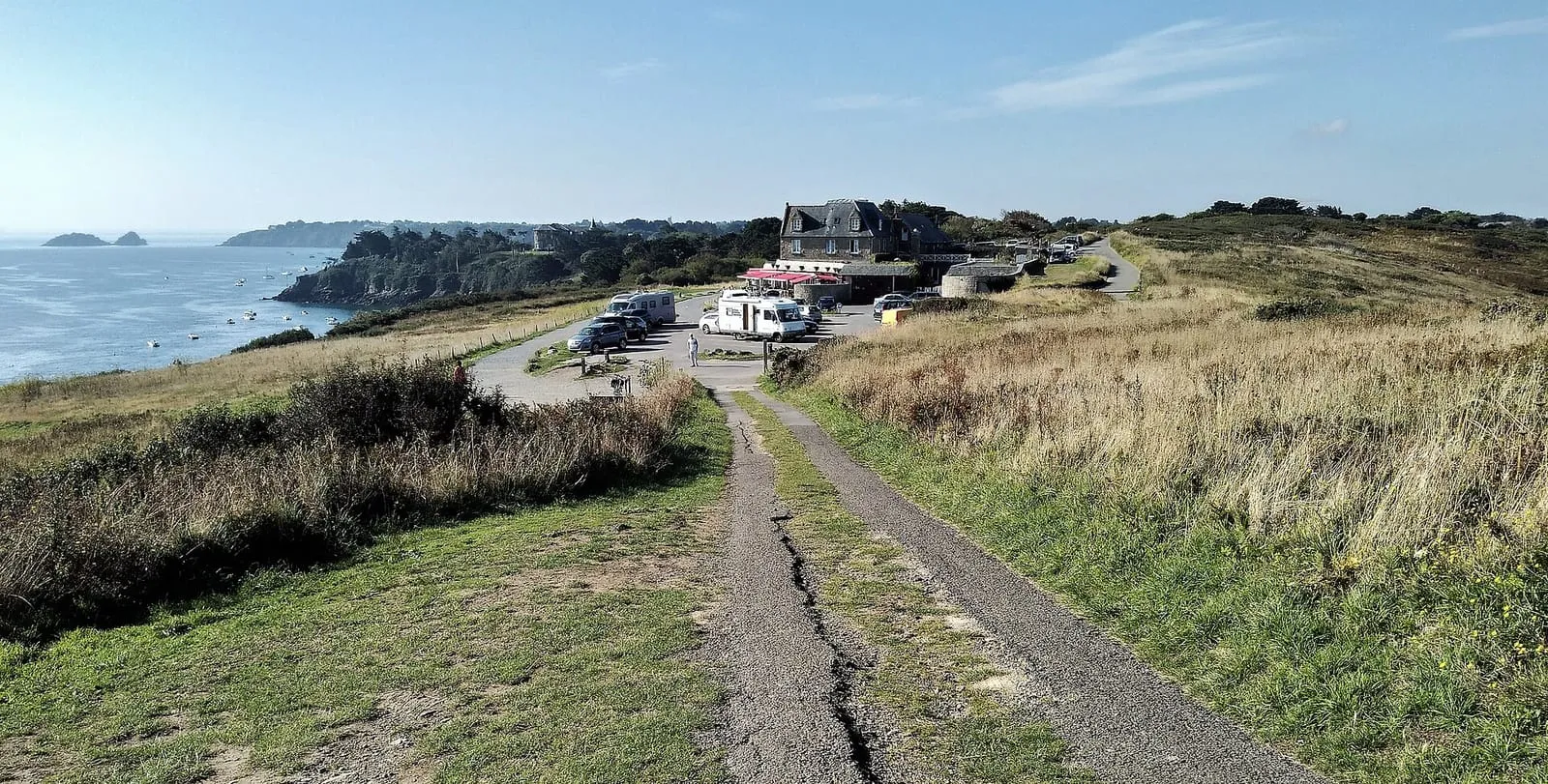

North of Cancale, the Pointe du Grouin juts into open water at the exact hinge of two worlds: to the east, the bay of Mont-Saint-Michel and its horizons of sand; to the west, the Emerald Coast and its granite capes. Few places sum the region up so well, and few offer, in a single walk on the GR34, so many different landscapes.
A balcony between two worlds
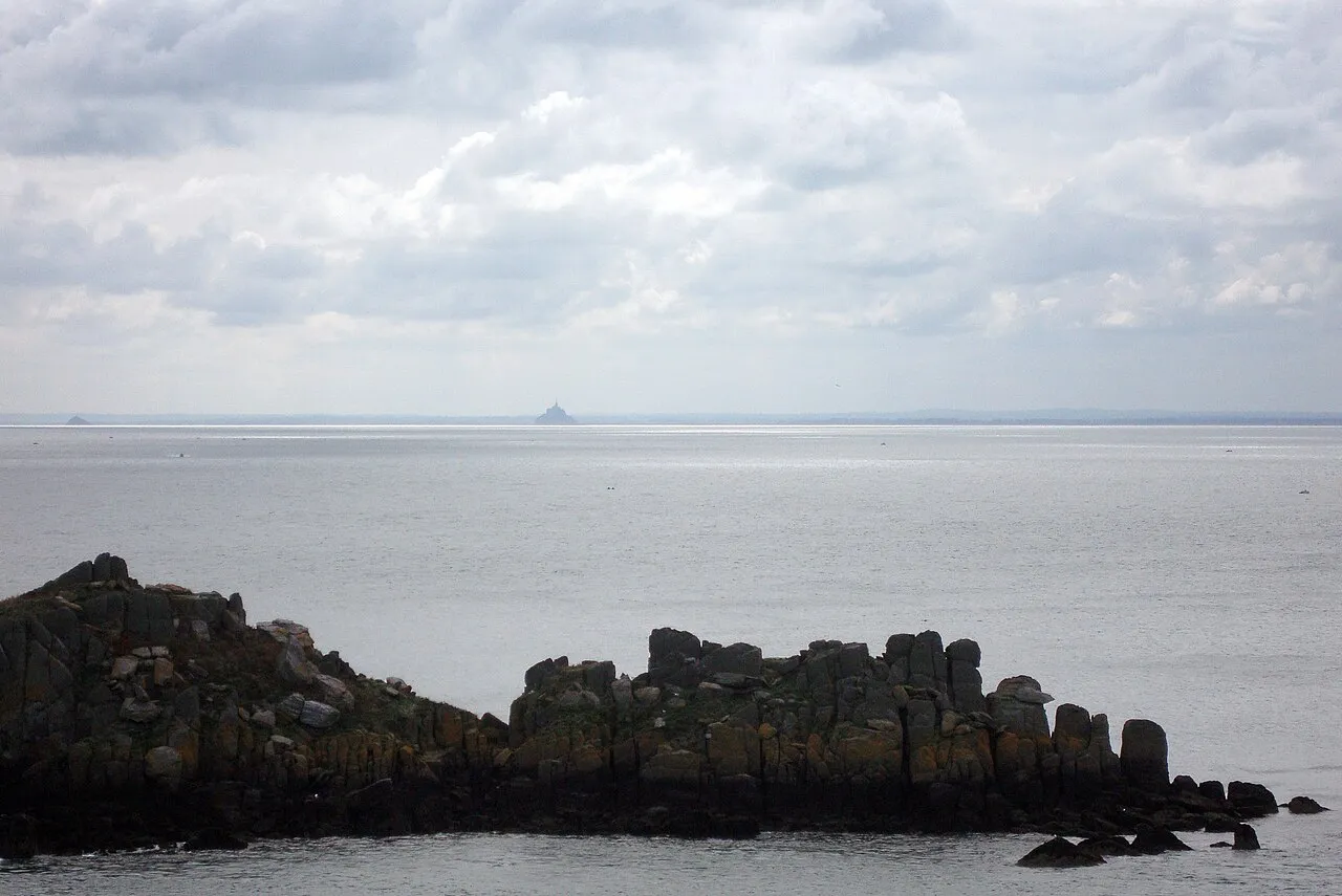
From the point, the panorama reads like a map: on a clear day the eye carries all the way to Mont-Saint-Michel, a silhouette set at the head of its bay; on the other side, the coast runs off towards the headlands and beaches of Saint-Malo’s surroundings. On the point itself, a signal station watches over the passage, a reminder that this promontory has always been first a sea-watching post, and that people have come here for the same reason forever: to see far.
The Île des Landes and the Pierre-de-Herpin lighthouse
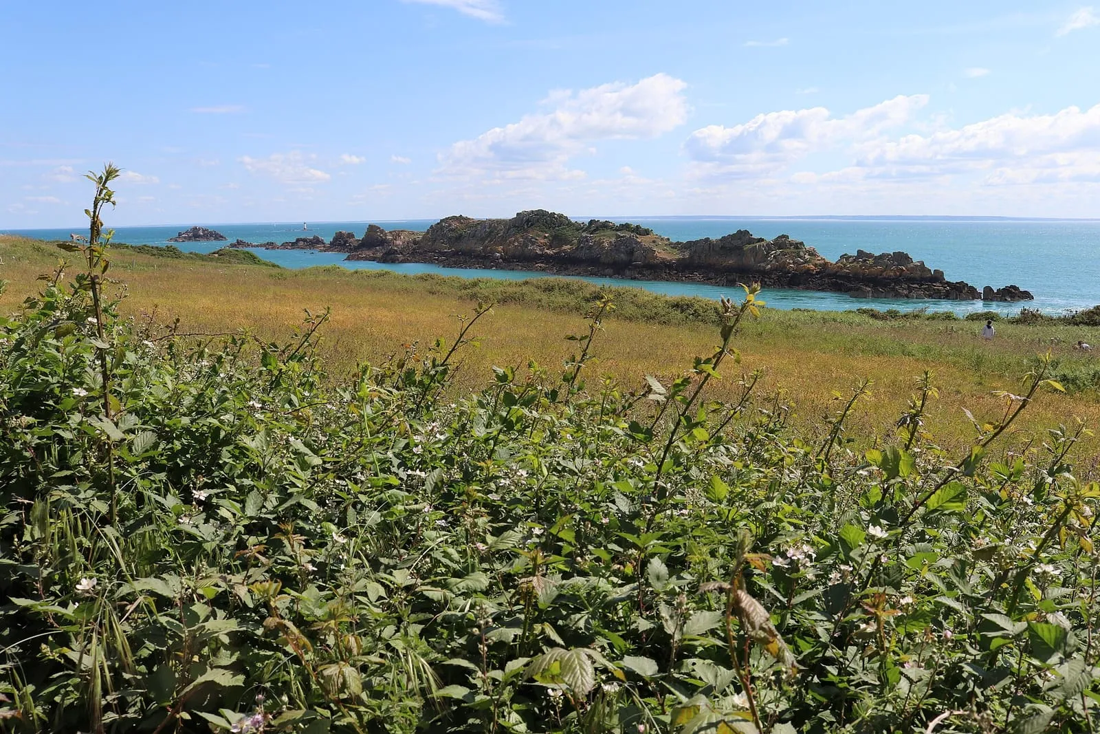
Facing the headland, the Île des Landes stretches out its rocky spine: a bird reserve where seabirds nest, watched from the paths, binoculars in hand. Offshore, the Pierre-de-Herpin lighthouse marks the entrance to the bay and completes the picture. On the spring tides, the arm of sea between the point and the island becomes a corridor of powerful currents: the water races through like a river, and the show is watched from the top of the paths, never from the rocks at the water’s edge.
Route du Rhum, spring tides and prudence
Every four years, the headland becomes one of sailing’s great grandstands: the start line of the Route du Rhum is laid offshore, and the fleet sets off before the spectators massed on the promontory. Our start-day page covers the 2026 edition. The rest of the time, the point is sufficient unto itself: a loop on the GR34, a picnic out of the wind, the light turning over the bay.
A word of caution, because the place demands it: the paths run along the cliff edge, the wind often blows hard, and the rocks at the foot of the point are beaten by the sea, on a rising tide as in swell. Stay on the paths, do not climb down towards the rocks, and keep children close. The headland, its neighbours and the coast’s other balconies are gathered on the interactive map.
Written and kept up to date by a Saint-Malo local in love with this coast. The story behind this guide
_-_01.jpg)

What can you see from the Pointe du Grouin?
On one side, the bay of Mont-Saint-Michel (with the Mont itself on a clear day), on the other the Emerald Coast. Facing the headland, the Île des Landes; offshore, the Pierre-de-Herpin lighthouse; on the point itself, a signal station watches over the passage.
Can you visit the Île des Landes?
The Île des Landes is a bird reserve where seabirds nest: it is watched from the headland's paths, binoculars in hand. On the spring tides, the passage between the point and the island runs with strong currents: a show in itself, watched from above.
Does the Route du Rhum start from the Pointe du Grouin?
The race's start line is laid offshore of the headland: it is one of the great natural grandstands to watch the fleet set off. Expect exceptional crowds that day, and come early.