The GR34 around Saint-Malo: walking the customs officers' path with the tides
Updated on 31 July 2026
_-_01.jpg)
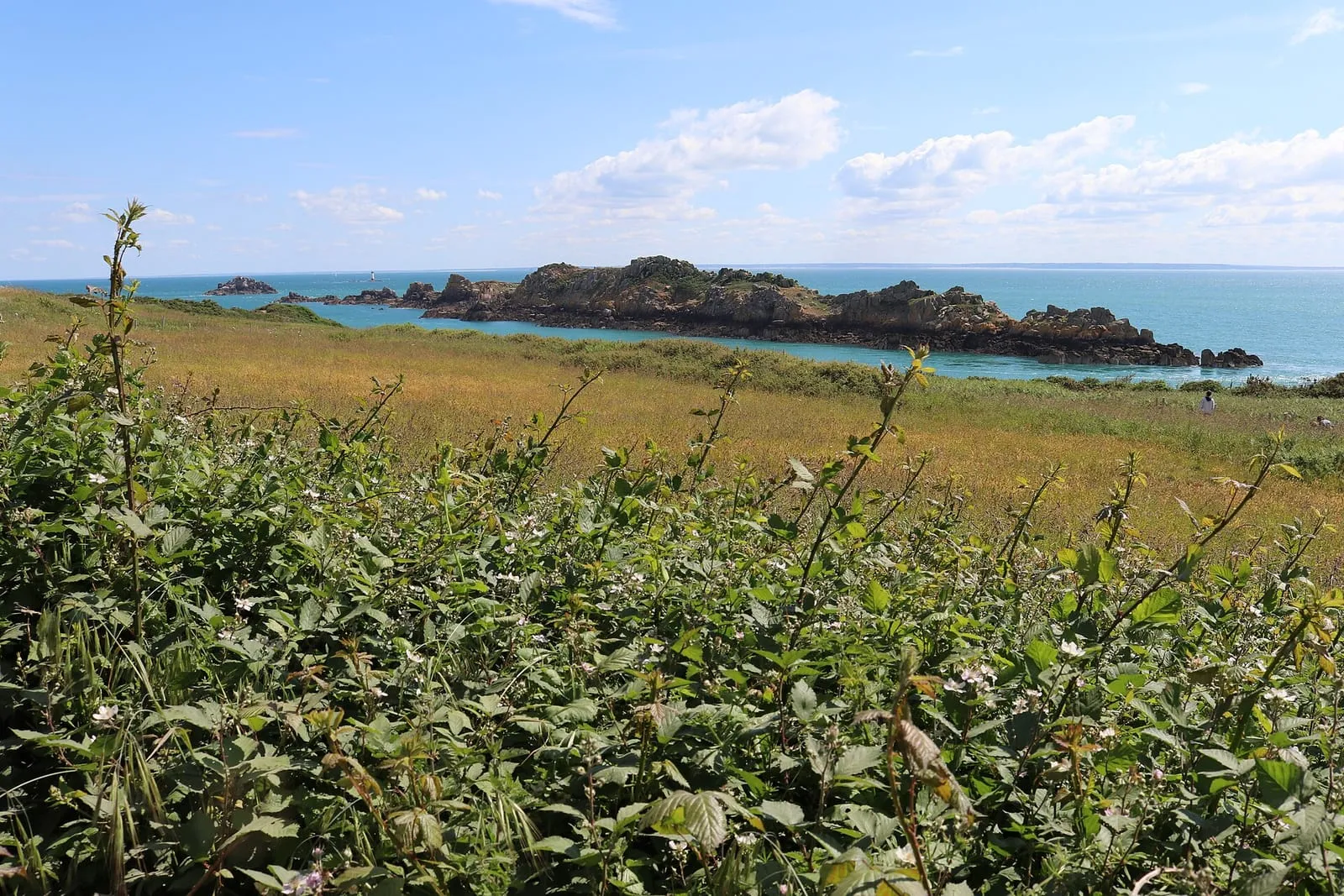
A white-and-red blaze runs the length of the Emerald Coast, painted on rocks, low walls and heathland posts: the GR34, known in French as the sentier des douaniers (the customs officers’ path), which follows the Breton coastline for some two thousand kilometres. Around Saint-Malo it strings together sea walls, beaches, headlands and cliffs through scenery the tide redraws twice a day, and that is what makes walking here distinctive: when you set off matters as much as which section you pick. This page gathers the finest day walks from the corsair city, all within easy reach of Saint-Malo, and explains how to get the best of them with nothing more than a calendar of tidal coefficients.
The customs officers’ path, from watch duty to walking trail
The GR34 owes its nickname to the customs officers who once patrolled these rounds to catch smugglers: the job required a clear view into every cove, so the path went everywhere, hard against the water. Today’s trail inherited that logic, rarely cutting inland where it can hug the shoreline instead, along with the standard French long-distance waymarking: two horizontal stripes, white over red, painted on rocks, fences and wall corners, with their variants to announce the turns. Around Saint-Malo, this thread crosses every landscape the Emerald Coast owns: an urban seafront, dunes, heather moors, sandstone drops. It asks for no long-distance ambitions either: every section can be joined and left wherever you like, often minutes from a coach stop or a slipway.
Four day-walk sections around Saint-Malo
The first walk starts at the ramparts themselves: from Saint-Malo to Rothéneuf along the shore, the path follows the long Sillon beach, rounds the Pointe de la Varde (the first true lookout of the coast), then strings the Minihic, Pont and Val beaches together as far as the Rothéneuf inlet, which the tide empties and refills like a lagoon. It is the most accessible section: you begin on foot from Intra-Muros and come back by local bus (Rothéneuf is a district of the city) or the way you came. Strong walkers push on towards La Guimorais and, over one very long day or two stages, all the way to Cancale: the classic Saint-Malo to Cancale coastal walk runs entirely on the GR34.
From the Pointe du Grouin down to Cancale, the path tips from one world into another: to the north, the open sea and the Île des Landes; to the east, the vast bay of Mont-Saint-Michel, whose foreshore uncovers as far as the eye can see on the big low tides. The descent to the port of La Houle, between moorland and coves, ends among the oyster beds, reason enough to close the walk with a dozen on the jetty.
From Dinard to Saint-Briac, the register changes: the shuttle boat drops you below the Pointe du Moulinet, and the path links Belle Époque villas, the beaches of Saint-Lunaire and the Pointe du Décollé before the coves of Saint-Briac. This is the gentlest section, carved through the headlands, with Saint-Malo in full view as you set out.
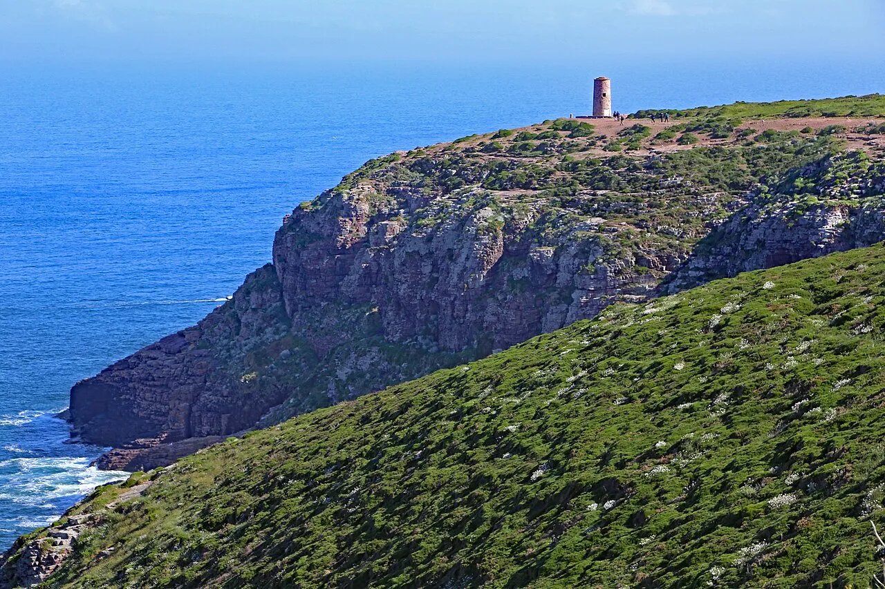
From Cap Fréhel to Fort la Latte, finally, the Emerald Coast reaches its most dramatic stretch: about four kilometres of coastal path between the pink sandstone cliffs (some seventy metres of sheer drop), the moor and the fortress planted on its rocky spur. Allow an hour’s drive to reach the cap, and half a day on site for the out-and-back walk, binoculars included: the cliffs shelter a major seabird reserve.
What the tide actually changes on the trail
Two walkers following the same route six hours apart are not doing the same walk. At low tide, the foreshore doubles the scenery: the sea pulls far out, the beaches turn into huge esplanades of firm sand, Cancale’s oyster beds surface, and several stretches can be walked on sand rather than on the path, between the Sillon and Rothéneuf in particular, where you drop from one beach to the next. At high water, the stage shrinks: the beaches vanish, the flood beats against the rock armour, and a few low passages are turned by the upper path: nothing impassable, but no longer the same day out. On the big coefficients, finally, the show changes scale: the sea rises higher, falls lower, and the exposed points take the spray. The capes rank among the best spring tide viewpoints, to watch from a safe distance, behind shelter.
Set off on a falling tide: the simple method
The golden rule fits in one sentence: to make the most of the beaches and foreshore, time your start for the beginning of the falling tide. You then walk for hours ahead of a retreating sea, and the sandy passages stay open behind you. Start mid-flood instead, and the beaches close one after another as you go. On spring tide days, aim for coefficients above 90 to see the foreshore at full stretch; we publish dates and coefficients only: for the day’s times, check the official SHOM tide tables before any outing.
The precautions that go with it
The GR34 is not a technical trail, but it is walked with the sea for a neighbour and the wind for company. Only cross a beach or a stretch of foreshore on a falling tide, never while the flood is coming in; at the foot of cliffs and headlands, never let the sea cut off your line of retreat: it returns faster than you expect, and some coves have no way out from above. On the cliff sections, stay on the waymarked path: the edges are neither fenced nor always visible in the heath, and the wind, at times violent on the capes, is one more reason to keep well clear of the drops. A windproof jacket, water and shoes with grip cover the equipment side; caution and a checked tide time do the rest.
Getting there and back without a car
Three of the four sections need no car. The Rothéneuf walk begins on foot from the ramparts, with a bus for the return; the Dinard section opens with ten minutes of shuttle boat from the Cale de Dinan, the finest approach there is; Cancale and the Pointe du Grouin are served by BreizhGo coaches from Saint-Malo station, with timetables to check by season. Only the Cap Fréhel–Fort la Latte pair calls for a car, about an hour’s drive to the west. Whichever section you choose, carry a way to check the tide as you walk, and leave yourself a margin on the last coach of the evening.
Written and kept up to date by a Saint-Malo local in love with this coast. The story behind this guide



Check the official tide times on maree.shom.fr ↗
What exactly is the GR34?
A long-distance footpath following the Breton coastline for some two thousand kilometres, waymarked in white and red. It reuses the rounds once patrolled by customs officers watching for smugglers, hence its French nickname, the sentier des douaniers. Around Saint-Malo it serves the whole Emerald Coast, from the bay of Mont-Saint-Michel to Cap Fréhel.
Which is the most beautiful section near Saint-Malo?
Each has its own register: Saint-Malo to Rothéneuf for ease and beaches, Pointe du Grouin to Cancale for the swing over the bay of Mont-Saint-Michel, Dinard to Saint-Briac for villas and coves, Cap Fréhel to Fort la Latte for the cliffs. If you only walk one and have a car, the Fréhel–la Latte pair wins, for its cliffs.
Can you walk on the beach instead of the path?
Often, yes: at low tide several stretches, between the Sillon and Rothéneuf in particular, can be walked on sand. The safety rule is strict: only cross a beach on a falling tide, never while the flood is coming in, and check the official SHOM tide tables before setting out.
How hard is the GR34, and what should you bring?
The trail is not technical, but the climbs in and out of the headlands add up, and it is very exposed to the wind. Shoes with grip, a windproof layer, water and a way to check the tide are enough for the day sections.
Can you reach the GR34 without a car?
Yes, for three sections out of four: on foot from the ramparts towards Rothéneuf, by shuttle boat to Dinard, by BreizhGo coach to Cancale and the Pointe du Grouin. Only Cap Fréhel calls for a car, about an hour's drive away.