Between Saint-Malo and Dinan, the Rance is neither quite a river nor an arm of the sea: it is maritime countryside, where fishermen’s lanes watch sailboats pass between curtains of oaks. This is the gentlest of the day trips: a day of slipways, villages and viewpoints, opened by the tidal barrage that tamed Europe’s biggest tidal range here.
A river under influence
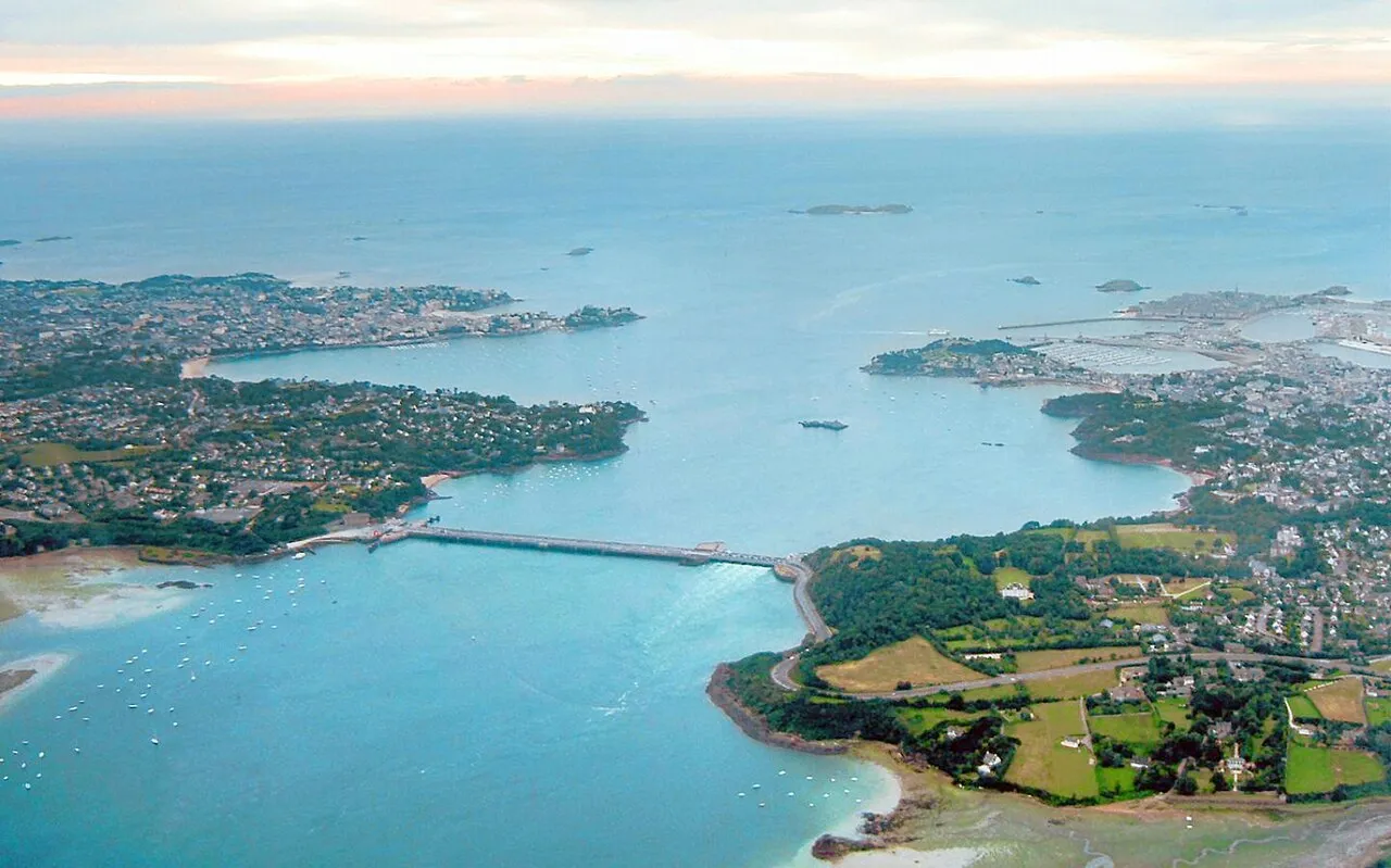
A peculiarity unique in France: between the barrage and the Châtelier lock, the Rance’s levels follow the power station’s operating cycles more than the moon. The range is reduced, the hours offset: the standard tide tables do not apply, and the flats can cover without warning. For the visitor the consequence is twofold: the waterside scenery changes through the day as it does at sea, but caution is due at the water’s edge. And for the coast beyond the barrage, the official SHOM tide times remain the reference.
The villages, bank by bank
Saint-Suliac first, listed among France’s most beautiful villages: tight lanes running down to the slipway, fishing nets on the façades, and the Mont Garrot above for the panorama over the whole valley. The Mordreuc slipway next, on the left bank: a photogenic halt where children fish for crabs below the carrelet fishing huts. Dinan finally, at the head of the tidal Rance: the medieval town perched on its spur, its port below where the river barges once moored, and the climb up the rue du Jerzual as a journey through time. Between the three, both banks string together malouinières, tide mills and quiet coves: the list below details them, entries and access included.
The gentle day
This is the itinerary for grey days, the day after a spring tide, or afternoons without a schedule: cross the barrage (stop at the viewpoint), Saint-Suliac for noon, Mordreuc mid-afternoon, Dinan at the day’s end, back along the other bank. Almost no tide arithmetic, no crowds, and a river light that belongs to this valley alone. Walkers stretch it out on foot: paths follow the Rance for most of the way, from the Corbières park to the quays of Dinan.
The small islet in the middle of the Rance, just upstream of the tidal power station's dam, topped since 1897 by a statue of the Virgin facing the open sea. It is the water-level marker of the Rance: depending on the plant's releases, its base is left dry or almost entirely covered, a stone gauge you quickly learn to read. Watch it from the dam, the Alet headland or the Corbières park, each offering a different angle on the estuary. A useful reminder: upstream of the dam the 'tide' is driven by the power station. SHOM tide times do not apply there, and the level can change at any hour.
Cancaval headland
Rance valley
On the Pleurtuit bank, opposite Quelmer, the Cancaval headland juts out as a wooded spur above the broad basin of the Rance. From the path the view runs from the dam to Saint-Suliac: a good place to watch the river's shifting levels, as mudflats and banks uncover and vanish to the rhythm of the tidal power station. Here the water does not follow the natural tide table, and the scenery can change within the hour. Below, the Montmarin manor and its gardens step down to the water. Reached on foot from Jouvente along the coastal path; keep to the path, as the uncovered shores are treacherous.
Châtelier lock and Lyvet port
Rance valley
This is where the sea ends. The Châtelier lock marks the limit of the maritime Rance: downstream, the estuary and its tide; upstream, the placid canal leading to Dinan. Lockages only happen when the water is high enough, around high tide, and the little port of Lyvet lives to that rhythm, between waiting yachts and square-net fishermen. Arrive around high water to watch the ballet of boats; at low tide the ria is nothing but channels and mudflats. From the bridge you take in the contrast of the two worlds; crêperies and a slipway on site. A perfect destination along the Rance cycleway.
Dinan
Rance valley
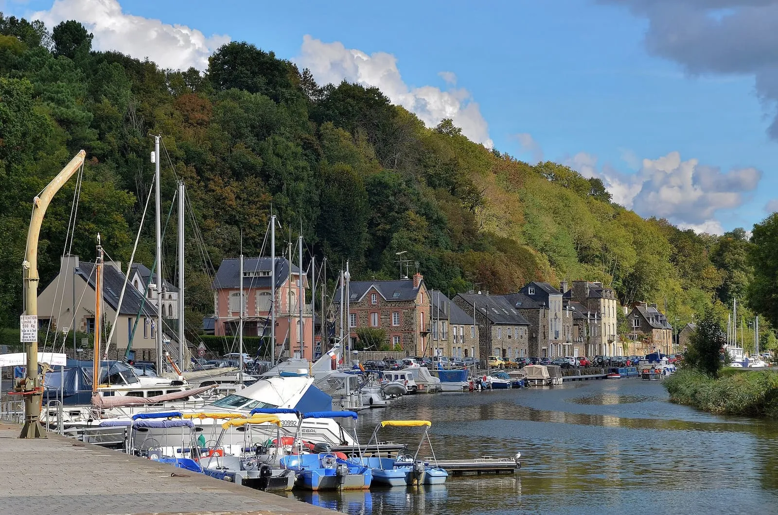
Thirty kilometres upstream, Dinan is Brittany's most complete medieval town: nearly three kilometres of ramparts, whole streets of timber-framed houses, and the vertiginous Rue du Jerzual tumbling down to the port. The tide still climbs this far: the Rance is maritime up to the nearby Châtelier lock, and the little port at the head of the ria lives to the rhythm of the flood. Cruising up the Rance by boat from Saint-Malo, along an estuary the tide endlessly redraws, is the finest way to arrive; allow a full day to wander between port and ramparts.
La Landriais (Le Minihic-sur-Rance)
Rance valley
On the left bank of the Rance, the Landriais cove was one of the estuary's great shipyards: Newfoundland schooners and coasters were built here in wood, and the 19th-century dry dock, known as the “cale de l'Épine”, can still be read in the foreshore. It shows best at low tide, keeping an eye on the flood, which returns quickly in the ria. The path along the bank strings together mossy slipways, bird-filled mudflats and stone villages: the painters' Rance, twenty minutes from Saint-Malo. A few yards here keep traditional wooden boatbuilding alive.
Montmarin estate
Rance valley
The only malouinière built on the left bank of the Rance, at Pleurtuit: raised in the 18th century for a shipowner who added a shipyard and a slipway on the estuary, proof that these country houses stayed turned towards the sea and its business. Its terraced gardens, listed as a “remarkable garden”, step down to the water, mixing French parterres with a scented garden; from the terraces you can follow the tide's comings and goings on the estuary. The place sums up what the maritime Rance was: Saint-Malo's second seafront, lined with residences and slipways. Open to visitors in season; check the hours.
Mordreuc slipway (Pleudihen-sur-Rance)
Rance valley
One of the finest spots on the maritime Rance, halfway between Saint-Malo and the Châtelier lock. It is also one of the best places to grasp what the tide does to the estuary. At high tide the slipway dips into a tranquil lake; at low tide the estuary all but withdraws, uncovering mudflats, salt meadows and the hulks of old boats lying on their sides, a landscape at once Norman and Breton dominated by the ruins of Péhou castle. A café-guinguette on the slipway in season. The spectacle of the refilling, on the flood, is worth lingering an hour for; the mudflats themselves, though, are no place to wander: the mud is unforgiving.
Plouër-sur-Rance
Rance valley
Mid-estuary, on the left bank, Plouër hides its marina in a former mill cove: a sill holds the water back at low tide, so its boats float while the rest of the Rance lies dry, a direct legacy of the tide-mill dykes. The contrast is most striking at dead low water, when the brimming basin overlooks the emptied ria. Around it, granite hamlets, old slipways and a bankside path towards the Plouër slipway and Langrolay. A peaceful stage on the way up to Dinan, twenty-five minutes from Saint-Malo, ideal for a quiet walk far from the crowds on the ramparts.
Prat tide mill (La Vicomté-sur-Rance)
Rance valley
The maritime Rance once counted more than a dozen tide mills: a dyke closes off a cove, the sea fills it on the flood, and the water released on the ebb turns the wheel. It is the same principle as the tidal power station, five centuries early. The Prat mill, attested from the 15th century, was rescued and restored to working order by an association; in summer, visits and demonstrations show the machinery at work, to a timetable set by the tide itself. All around, the adjoining cove, its salt meadows and its path sum up the Rance as it was before the dam. Come on a rising or falling tide to watch the water move.
Visits and demonstrations in summer; check the dates.
Rance dam surroundings: caution
Rance valley
Near the dam, the Rance no longer obeys the moon alone: the power station's turbine runs and sluicings create violent currents and shift the estuary's level out of step with the natural tide. A peaceful foreshore can thus be covered in minutes, with no wind or swell to give warning. Swimming and boating are forbidden in the dam's safety zone, and on every Rance shore one rule applies: the water can rise earlier and faster than the tide table announces. Leave no gear and no children at the water's edge on the slipways, and keep a constant eye on the level.
Rance tidal power station
Rance valley
Commissioned in 1966, the world's first industrial-scale tidal power station: its 24 turbines generate electricity in both directions, on the flood and on the ebb. The exceptional tidal range of the Rance has been turned into energy for sixty years. Nowhere else on this coast does the local tide show itself so concretely as a working force. The dam carries the road linking Saint-Malo to Dinard, with a lock for boats. The visitor centre on the right bank explains how it all works; check that it is open before making the detour.
Saint-Suliac
Rance valley
On the left bank of the Rance, one of the officially listed Most Beautiful Villages of France: fishermen's lanes lined with low walls where nets still sometimes dry, a fortified church within its close, gentle slipways on the estuary. A former Newfoundland-fishing village, whose women watched for the return of the cod schooners. From neighbouring Mont Garrot the view takes in the whole valley; at low tide the ria uncovers banks and old fish traps, a landscape reinvented twice a day. If you step down onto the foreshore, keep an eye on the time: the sea comes back quickly in the estuary.
The classic trio: Saint-Suliac and its fishermen's lanes, listed among France's most beautiful villages; the Mordreuc slipway, a photogenic waterside halt; and medieval Dinan, perched above its port at the head of the tidal Rance. Around them, malouinières, tide mills and viewpoints line both banks. Every place has its entry below.
Can you feel the tide in the Rance?
Yes, but differently from the open sea: between the tidal power station's barrage and the Châtelier lock, the levels follow EDF's operating cycles more than the moon. Slipways and flats cover and uncover at hours offset from the standard tide tables. Take care at the water's edge: the level can rise without warning.
How much time should you allow?
A gentle day covers it: Saint-Suliac at noon, Mordreuc mid-afternoon, Dinan at the end of the day, crossing the barrage on the way out or back. This is the outing for grey days or the day after a spring tide, the only one here that demands almost no tide arithmetic.
_-_La_Rance_-_Le_port_de_Dinan-Lanvallay_(50519407177).jpg)

,_quartier_de_Saint-Servan,_Saint-Malo.jpg)