Skip to content
Saint-Malo Guide

Dinan from Saint-Malo: the medieval town at the end of the tide

Updated on 28 September 2026

Dinan's port on the River Rance
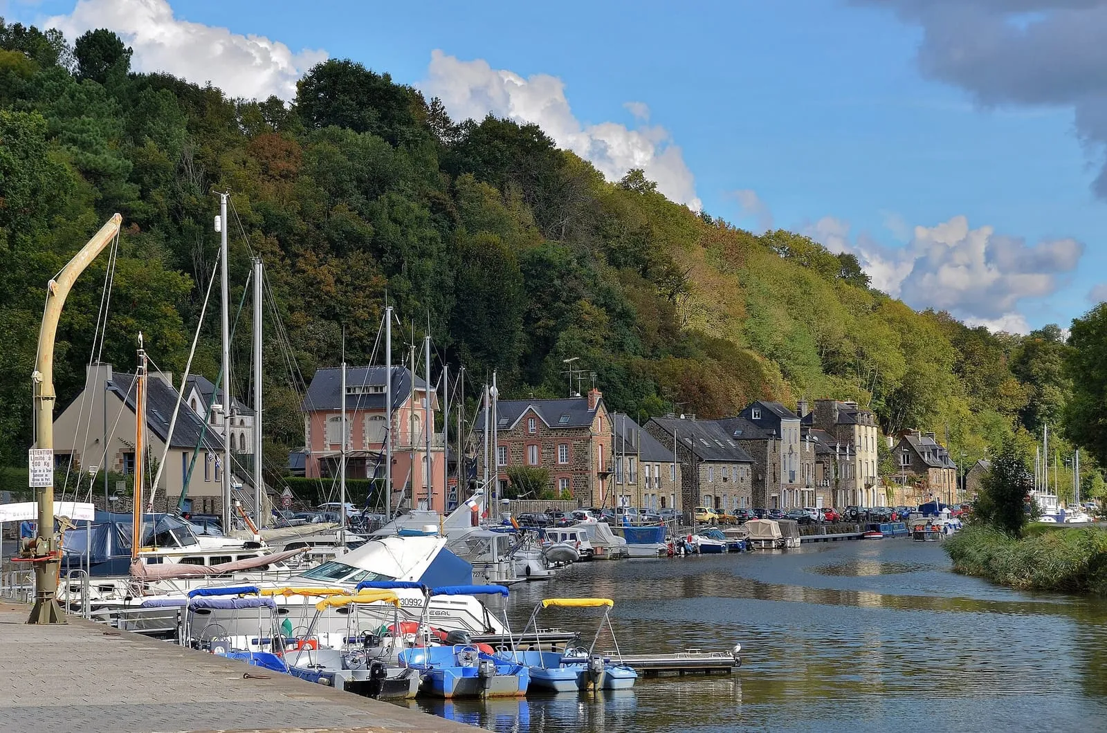
The port of Dinan-Lanvallay, below the walled town. — Photo Patrick from Compiègne, France (CC BY-SA 2.0), via Wikimedia Commons

Dinan stands at the head of the tidal Rance. Some thirty kilometres of road separate the corsair city from the medieval town, but the link reads most clearly by water: the same tide that rises against the ramparts of Saint-Malo climbs the estuary, passes the tidal power station’s barrage and dies out at the Châtelier lock, a few kilometres downstream of Dinan’s port. Above it, on its spur, the walled town keeps its ramparts, its timber-framed houses and the rue du Jerzual. It is the last stop in the Rance valley, and the most built-up.

Where the tide ends

For centuries, the port of Dinan was the break point between the tidal Rance and the river Rance, and the old bridge was the only land crossing all the way to the estuary. The Town of Dinan notes that the town first prospered from this position, trading early on with England and Flanders. Today, the boundary lies at the Châtelier lock, by the little port of Lyvet. Downstream, the Rance lives to the rhythm of the tide; upstream, the river is canalised as far as the port of Dinan and beyond.

Between the barrage and the Châtelier, this tide is not quite the sea’s. The tidal power station controls how the basin fills and empties, and EDF publishes its level forecasts for the Saint-Suliac tide gauge. The SHOM tide times for Saint-Malo therefore do not apply as they stand on the Rance: for water heights above the barrage, check the Rance water levels page.

Arriving by boat: a cruise set by the locks

In season, the Compagnie Corsaire runs a commented cruise from Saint-Malo or Dinard to Dinan. The trip takes 2 h 45 each way. The boat first goes through the barrage lock, which operates on the hour provided the sea-side level reaches at least 4 metres above chart datum. It then sails up the estuary, past fishing villages and malouinières, where the river widens like a lake before narrowing between steep banks, and finally through the Châtelier lock, which only opens when the tidal Rance holds enough water.

These two locks set the timetable. The company warns that its departures may change according to the requirements of the barrage and the Châtelier, and the Dinan tourist office states that cruise times depend on the tides. Departure dates only appear when you simulate a booking on the company’s website. For the return, the company chartered a coach this summer between place Duclos in Dinan and the Porte de Dinan in Saint-Malo. Check these arrangements when you book: they change from one season to the next.

Other ways to get there

By coach, line 10 of the regional BreizhGo network links Dinan and Saint-Malo; in Saint-Malo, it serves the “Gares” stop. By train, you change at Dol-de-Bretagne: the Saint-Malo–Dol TER takes about a quarter of an hour, then another line runs on to Dinan. By car, allow some thirty kilometres. By bike, according to the tourist office, the old railway line turned greenway links Dinard to the port of Dinan: an option if you are staying on the left bank. For all of these, check the timetables with the operators on the day.

The port and the rue du Jerzual

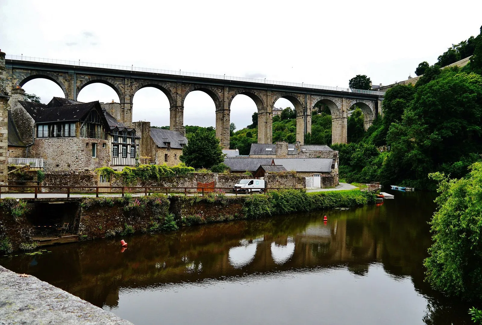
The port of Dinan-Lanvallay stretches along both banks, below the viaduct. According to the Town, the opening of this structure in 1852 permanently sidelined the old climb up the Jerzual. The quays are now a stopping point for walkers, cyclists and boaters, with café terraces along the water.

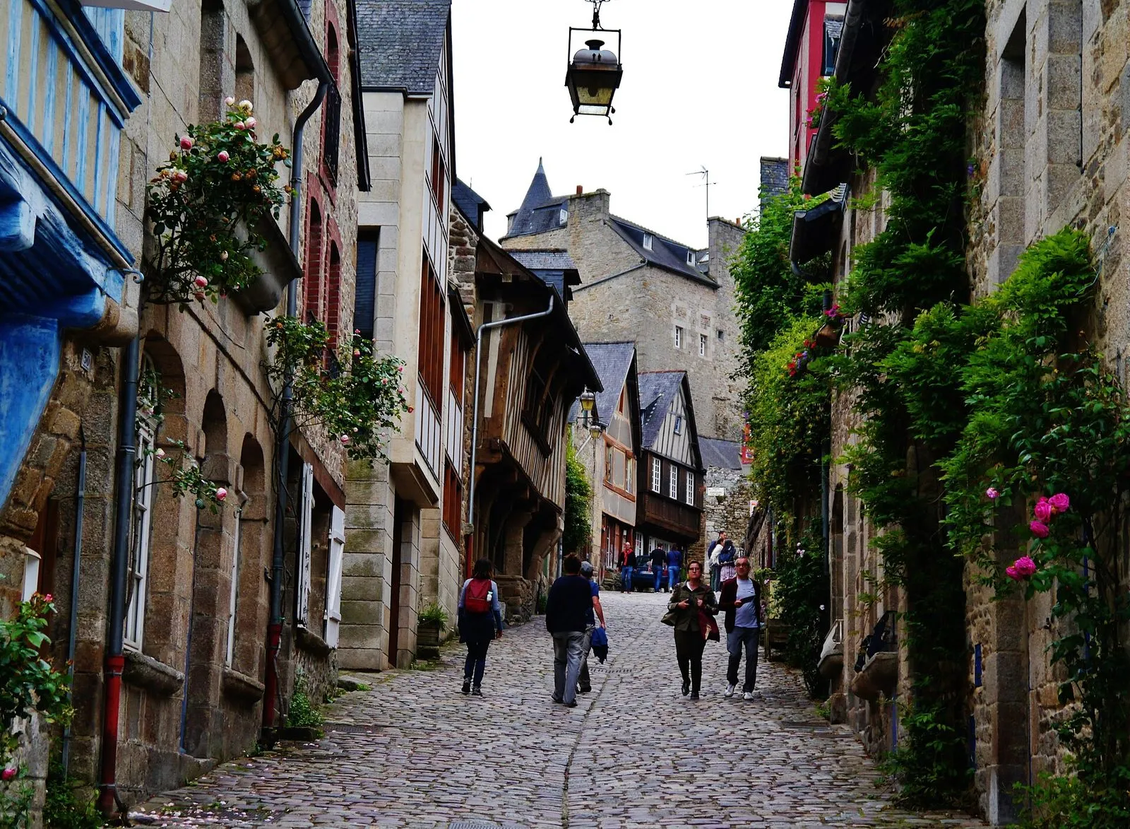
From the port, the rue du Petit-Fort climbs to the Jerzual gate, then becomes the rue du Jerzual up to the historic centre. In the Middle Ages it was the only way to the port. The slope is steep, the cobbles uneven, and the stone and timber-framed houses are now home to artists’ and craftspeople’s workshops. The climb calls for good shoes, and the descent for just as much care.

Ramparts, castle, clock tower and Saint-Sauveur

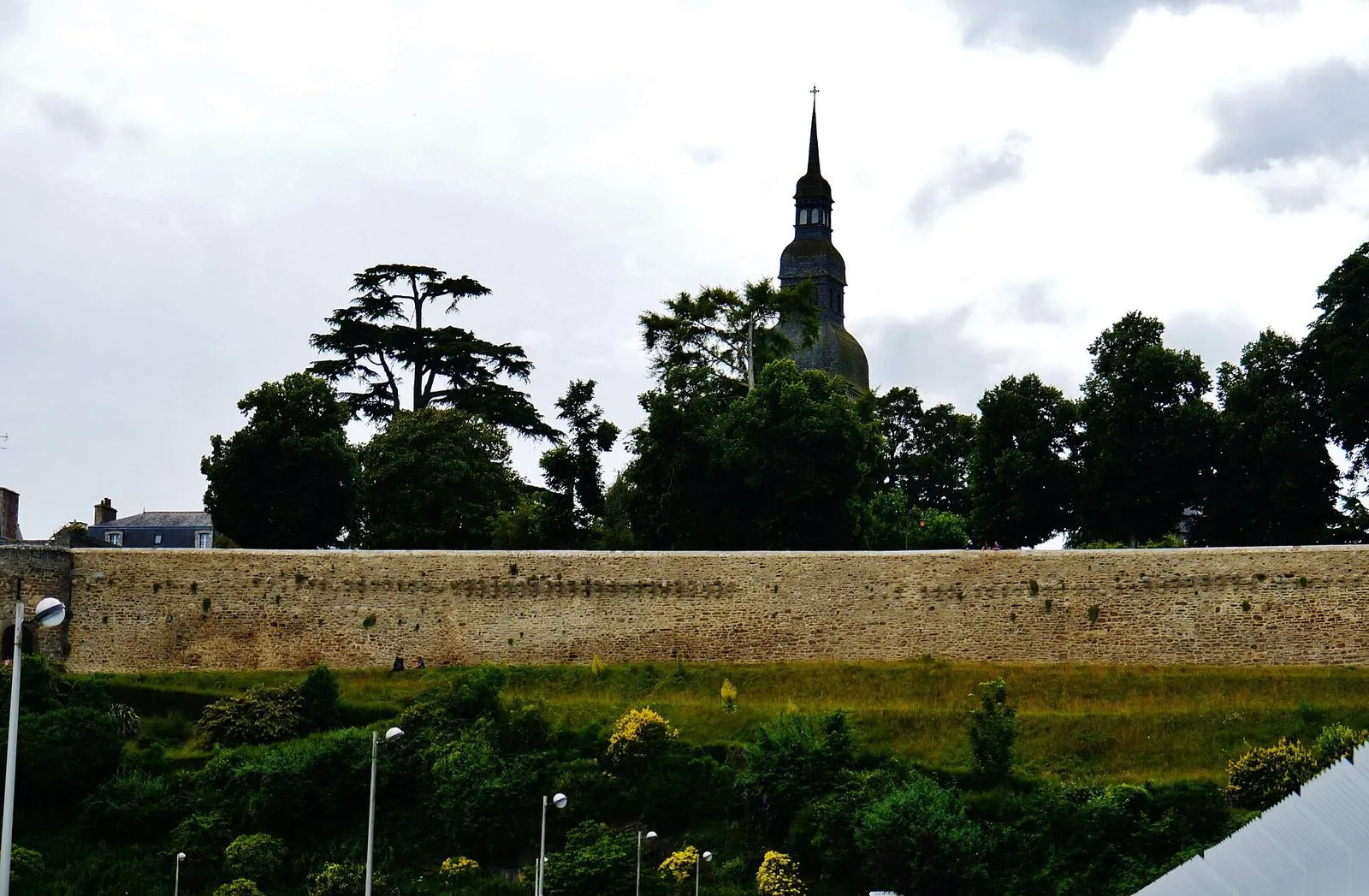
The ramparts still enclose the historic centre for nearly 2.7 kilometres, with four gates. The Town describes them, in the time of the dukes, as the largest in Brittany after those of Nantes and Rennes. The demolition of the Porte de Brest in 1881 led to their listing as a historic monument in 1886. The tourist office offers a “Tour des Remparts” walk of about 1 h 30, which can be combined with its “Vieux Dinan” (Old Dinan) route.

The castle, at the south end of the old town, is a palace-tower built from 1380 for Duke John IV. The castle’s own website dismisses the name “Duchess Anne keep” as folklore. Long a prison, then a museum, it saw its collections moved into storage between 2014 and 2018; since 2019, the visit focuses on the monument, court life and the art of war in the 14th century. In 2026 it is open from 4 April to 3 January 2027, daily until the end of September, then Tuesday to Sunday from October to December.

The clock tower (Tour de l’Horloge), raised in the 15th century by the town’s merchant class, stands more than 45 metres high; in season you can climb to the top for the view over the rooftops. The Basilica of Saint-Sauveur, first recorded in 1123, blends Romanesque and Gothic and holds the tomb containing the heart of Bertrand Du Guesclin. Right next to it, the Jardin Anglais, the parish’s former cemetery, leads to the Tour Sainte-Catherine and its plunging view over the port.

Along the Rance

The towpath leaves the port in both directions. Upstream, it leads to Léhon, its lock and its abbey of Saint-Magloire, on the canalised Rance. Downstream, it passes the Taden plain and reaches the port of Lyvet and the Châtelier lock: this is where the Rance becomes a tidal estuary again, and where boats wait for the lock to open.

When to go

Dinan is a good outing for a grey day: its streets and monuments can be visited in any weather, and the town is one of the shelters listed on the Saint-Malo in the rain page. Thursday is the big market day, a tradition the Town traces back to the Middle Ages. In 2026, the Fête des Remparts association is holding Arsonora, a medieval music festival, from 16 to 30 October in Dinan and the surrounding area; the Fête des Remparts itself, held every two years, is announced for July 2027.

The simplest combination remains the valley: the barrage, Saint-Suliac and the Mordreuc slipway on the way up, Dinan at the end of the day. The other day trips are on the around Saint-Malo page, and the Rance sites in the list below and on the interactive map.
Written and kept up to date by a Saint-Malo local in love with this coast. The story behind this guide

The cobbled rue du Jerzual in Dinan, lined with stone and timber-framed houses
The rue du Jerzual, linking the historic centre to the port. — Photo Zairon (CC BY-SA 4.0), via Wikimedia Commons
The Dinan viaduct over the Rance and the houses of the port
The viaduct, opened in 1852, spans the Rance above the port. — Photo Zairon (CC BY-SA 4.0), via Wikimedia Commons
A stretch of Dinan's ramparts above a wooded bank
Dinan's ramparts, listed as a historic monument in 1886. — Photo Zairon (CC BY-SA 4.0), via Wikimedia Commons

12 places, grouped by areaSee these places on the interactive map

Rance valley

Bizeux rock

Rance valley

The small islet in the middle of the Rance, just upstream of the tidal power station's dam, topped since 1897 by a statue of the Virgin facing the open sea. It is the water-level marker of the Rance: depending on the plant's releases, its base is left dry or almost entirely covered, a stone gauge you quickly learn to read. Watch it from the dam, the Alet headland or the Corbières park, each offering a different angle on the estuary. A useful reminder: upstream of the dam the 'tide' is driven by the power station. SHOM tide times do not apply there, and the level can change at any hour.

Cancaval headland

Rance valley

On the Pleurtuit bank, opposite Quelmer, the Cancaval headland juts out as a wooded spur above the broad basin of the Rance. From the path the view runs from the dam to Saint-Suliac: a good place to watch the river's shifting levels, as mudflats and banks uncover and vanish to the rhythm of the tidal power station. Here the water does not follow the natural tide table, and the scenery can change within the hour. Below, the Montmarin manor and its gardens step down to the water. Reached on foot from Jouvente along the coastal path; keep to the path, as the uncovered shores are treacherous.

Châtelier lock and Lyvet port

Rance valley

This is where the sea ends. The Châtelier lock marks the limit of the maritime Rance: downstream, the estuary and its tide; upstream, the placid canal leading to Dinan. Lockages only happen when the water is high enough, around high tide, and the little port of Lyvet lives to that rhythm, between waiting yachts and square-net fishermen. Arrive around high water to watch the ballet of boats; at low tide the ria is nothing but channels and mudflats. From the bridge you take in the contrast of the two worlds; crêperies and a slipway on site. A perfect destination along the Rance cycleway.

Dinan

Rance valley

Thirty kilometres upstream, Dinan is Brittany's most complete medieval town: nearly three kilometres of ramparts, whole streets of timber-framed houses, and the vertiginous Rue du Jerzual tumbling down to the port. The tide stops just downstream: the Rance is tidal up to the Châtelier lock, and above it the canalised river leads on to the little port below the town. Cruising up the Rance by boat from Saint-Malo, along an estuary the tide endlessly redraws, is the finest way to arrive; allow a full day to wander between port and ramparts.

Dinan from Saint-Malo: the medieval town at the end of the tide · Official website ↗

La Landriais (Le Minihic-sur-Rance)

Rance valley

On the left bank of the Rance, the Landriais cove was one of the estuary's great shipyards: Newfoundland schooners and coasters were built here in wood, and the 19th-century dry dock, known as the “cale de l'Épine”, can still be read in the foreshore. It shows best at low tide, keeping an eye on the flood, which returns quickly in the ria. The path along the bank strings together mossy slipways, bird-filled mudflats and stone villages: the painters' Rance, twenty minutes from Saint-Malo. A few yards here keep traditional wooden boatbuilding alive.

Official website ↗

Montmarin estate

Rance valley

The only malouinière built on the left bank of the Rance, at Pleurtuit: raised in the 18th century for a shipowner who added a shipyard and a slipway on the estuary, proof that these country houses stayed turned towards the sea and its business. Its terraced gardens, listed as a “remarkable garden”, step down to the water, mixing French parterres with a scented garden; from the terraces you can follow the tide's comings and goings on the estuary. The place sums up what the maritime Rance was: Saint-Malo's second seafront, lined with residences and slipways. Open to visitors in season; check the hours.

Official website ↗

Mordreuc slipway (Pleudihen-sur-Rance)

Rance valley

One of the finest spots on the maritime Rance, halfway between Saint-Malo and the Châtelier lock. It is also one of the best places to grasp what the tide does to the estuary. At high tide the slipway dips into a tranquil lake; at low tide the estuary all but withdraws, uncovering mudflats, salt meadows and the hulks of old boats lying on their sides, a landscape at once Norman and Breton dominated by the ruins of Péhou castle. A café-guinguette on the slipway in season. The spectacle of the refilling, on the flood, is worth lingering an hour for; the mudflats themselves, though, are no place to wander: the mud is unforgiving.

Plouër-sur-Rance

Rance valley

Mid-estuary, on the left bank, Plouër hides its marina in a former mill cove: a sill holds the water back at low tide, so its boats float while the rest of the Rance lies dry, a direct legacy of the tide-mill dykes. The contrast is most striking at dead low water, when the brimming basin overlooks the emptied ria. Around it, granite hamlets, old slipways and a bankside path towards the Plouër slipway and Langrolay. A peaceful stage on the way up to Dinan, twenty-five minutes from Saint-Malo, ideal for a quiet walk far from the crowds on the ramparts.

Official website ↗

Prat tide mill (La Vicomté-sur-Rance)

Rance valley

The maritime Rance once counted more than a dozen tide mills: a dyke closes off a cove, the sea fills it on the flood, and the water released on the ebb turns the wheel. It is the same principle as the tidal power station, five centuries early. The Prat mill, attested from the 15th century, was rescued and restored to working order by an association; in summer, visits and demonstrations show the machinery at work, to a timetable set by the tide itself. All around, the adjoining cove, its salt meadows and its path sum up the Rance as it was before the dam. Come on a rising or falling tide to watch the water move.

Visits and demonstrations in summer; check the dates.

Official website ↗

Rance dam surroundings: caution

Rance valley

Near the dam, the Rance no longer obeys the moon alone: the power station's turbine runs and sluicings create violent currents and shift the estuary's level out of step with the natural tide. A peaceful foreshore can thus be covered in minutes, with no wind or swell to give warning. Swimming and boating are forbidden in the dam's safety zone, and on every Rance shore one rule applies: the water can rise earlier and faster than the tide table announces. Leave no gear and no children at the water's edge on the slipways, and keep a constant eye on the level.

Official website ↗

Rance tidal power station

Rance valley

Commissioned in 1966, the world's first industrial-scale tidal power station: its 24 turbines generate electricity in both directions, on the flood and on the ebb. The exceptional tidal range of the Rance has been turned into energy for sixty years. Nowhere else on this coast does the local tide show itself so concretely as a working force. The dam carries the road linking Saint-Malo to Dinard, with a lock for boats. The visitor centre on the right bank explains how it all works; check that it is open before making the detour.

Official website ↗

Saint-Suliac

Rance valley

On the left bank of the Rance, one of the officially listed Most Beautiful Villages of France: fishermen's lanes lined with low walls where nets still sometimes dry, a fortified church within its close, gentle slipways on the estuary. A former Newfoundland-fishing village, whose women watched for the return of the cod schooners. From neighbouring Mont Garrot the view takes in the whole valley; at low tide the ria uncovers banks and old fish traps, a landscape reinvented twice a day. If you step down onto the foreshore, keep an eye on the time: the sea comes back quickly in the estuary.

Official website ↗

Check the official tide times on maree.shom.fr ↗

Frequently asked questions

How do you get to Dinan from Saint-Malo without a car?

Three options. The regional BreizhGo coach (line 10, Dinan–Saint-Malo) leaves from the "Gares" stop in Saint-Malo. The train requires a change at Dol-de-Bretagne. In season, the Compagnie Corsaire cruise sails up the Rance in 2 h 45 from Saint-Malo or Dinard, with a return by chartered coach on some days. Check the day's timetables on the operators' websites.

Does the Rance cruise depend on the tide?

Yes. The boat goes through the lock of the tidal power station's barrage, which operates when the sea-side level reaches at least 4 metres, then through the Châtelier lock, which also needs enough water. The company warns that its times may change according to the requirements of these two locks: book to get the departure time confirmed.

Can you visit Dinan castle?

Yes. The palace-tower built from 1380 for Duke John IV, long known as the "Duchess Anne keep", is open in 2026 from 4 April to 3 January 2027, daily until September, Tuesday to Sunday from October to December. The former museum collections have been moved into storage; the visit is about the monument itself.

How much time should you allow for Dinan?

Half a day covers the ramparts, the rue du Jerzual, the port and the Basilica of Saint-Sauveur. Allow a full day if you come by boat (2 h 45 each way), or if you add the castle or the riverside walk towards Léhon.