South of the ramparts, past the harbour basins, Saint-Malo wears another face: Saint-Servan, the village-quarter of quiet streets and sea captains’ houses, set between the roadstead and the Rance estuary. It is the tide’s other observation post (the one that watches it enter the river) and the town’s historic cradle, twenty minutes on foot from the walled city along the coastal path.
The Alet corniche: the town’s finest panorama
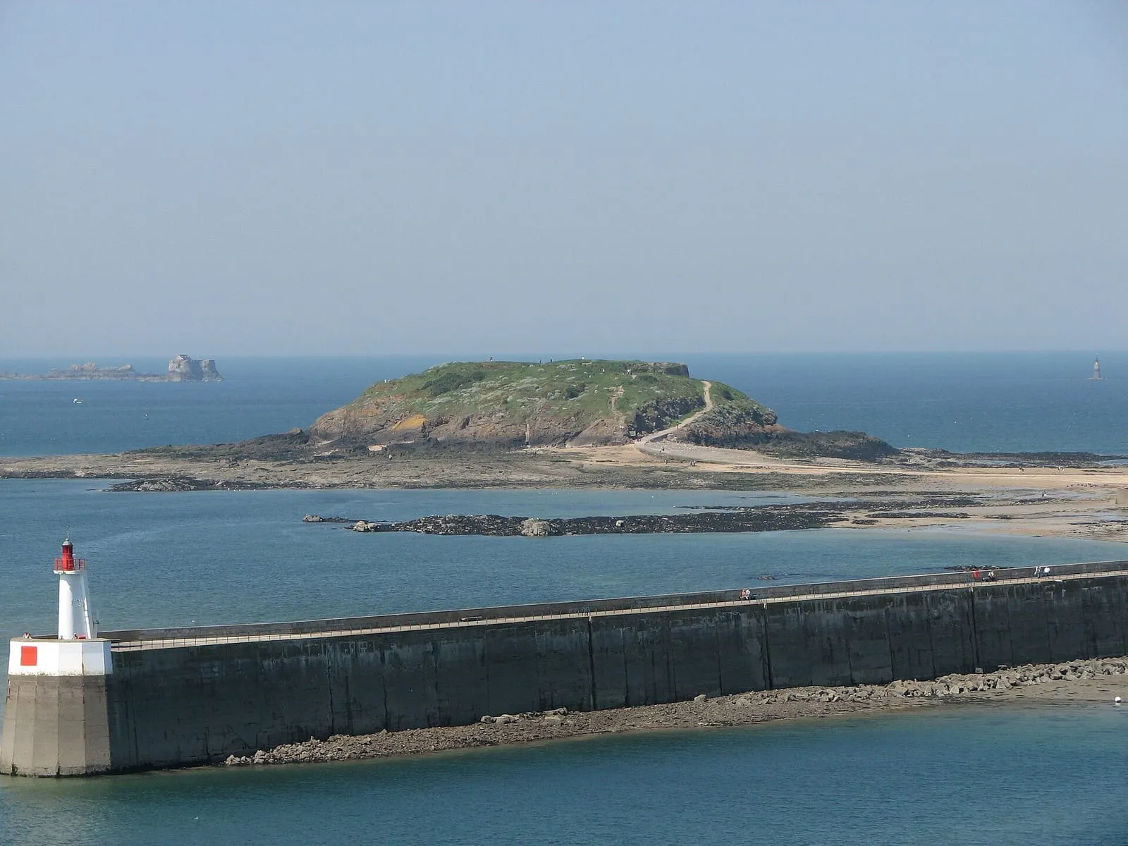
The Alet peninsula is Saint-Malo’s original site: a Gallo-Roman town and then an episcopal seat, before the population moved in the Middle Ages to the rock opposite, today’s Intra-Muros. What remains: stretches of rampart, a ruined cathedral, a fort, and above all the corniche, the balcony path that circles the headland under the trees. The panorama unrolls everything this site has to tell: the môle des Noires in the foreground, the walled city and its islets, Dinard opposite, the mouth of the Rance to the south. On spring tide days this is one of the best posts in the bay, high and sheltered, exactly as the rule requires: you watch high water ring the corsair city and pound the breakwater without catching a drop of spray.
Solidor: the keep that guards the river
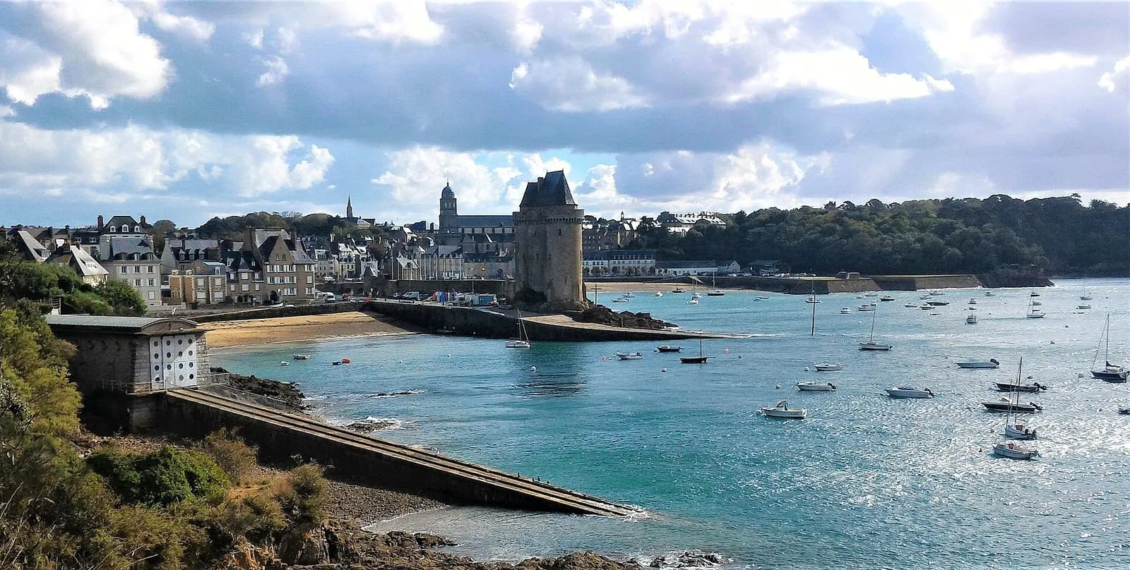
At the foot of the corniche, the Solidor tower has stood watch over the estuary since the 14th century: three towers bound into one keep, built to control passage on the Rance. The tide that surges through twice a day still gives the measure of what was at stake. The slipway at its foot is one of the most photogenic corners of town, boats settled on the mud at the ebb, afloat six hours later. Just behind begin Saint-Servan’s village streets, shops and terraces: the quarter for sleeping at gentler prices without giving up the sea.
The Bas-Sablons and the loop of the quarter
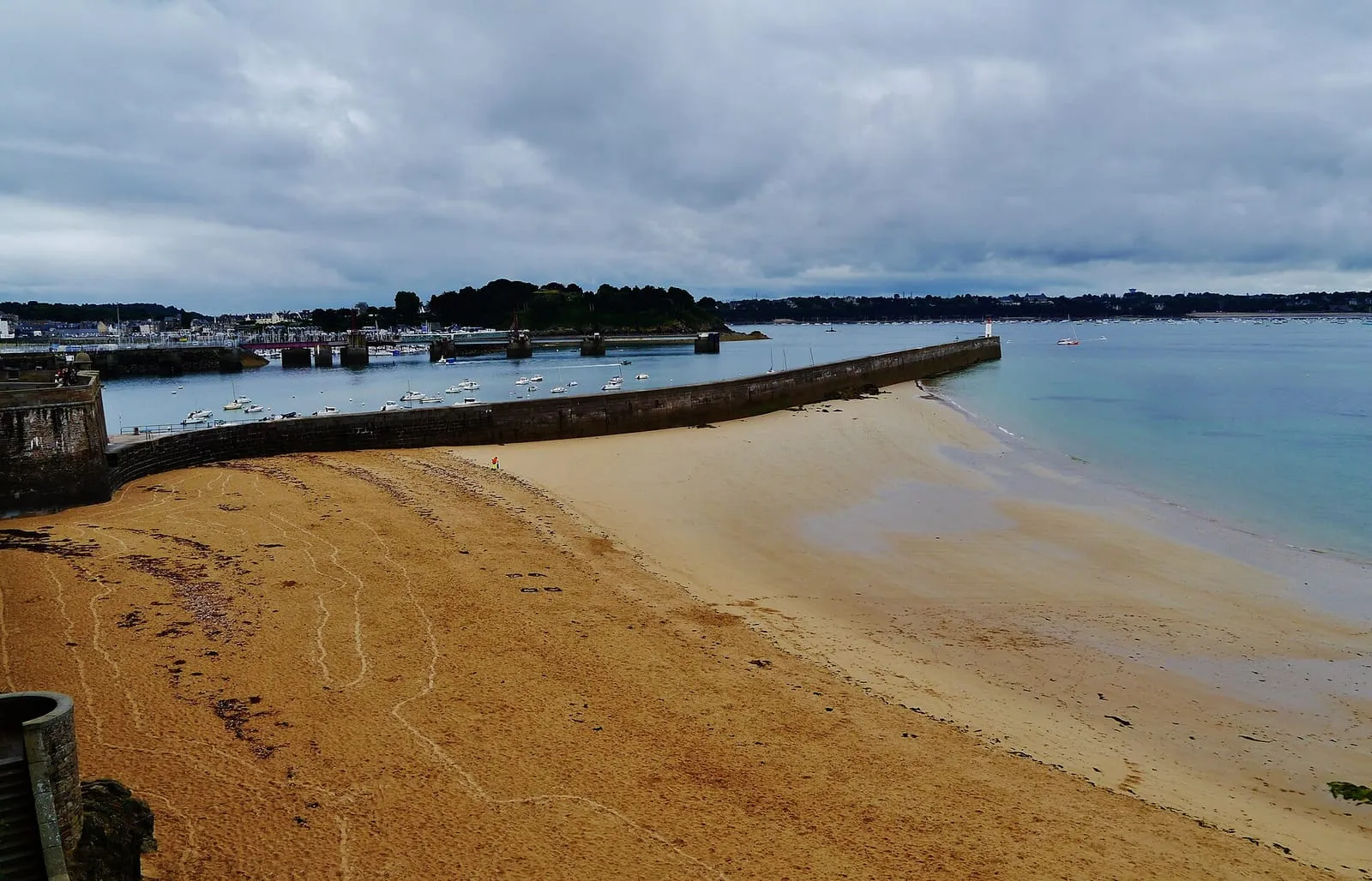
On the roadstead side, the Bas-Sablons marina lines up its pontoons below a sheltered, gently shelving beach, the most family-friendly in town, protected from the swell by the breakwater. The classic loop chains it all: Bas-Sablons beach, up to Alet by the corniche, down to Solidor, back through the lanes: a walk of an hour and a half, twice that with the pauses it deserves. The places on this page are detailed in the list below and on the map; for the hour of the high water that makes the show from the corniche, check the official SHOM tide times and the spring tide calendar.
This is where Saint-Malo began: the Alet peninsula carried the Gallo-Roman city and the first bishopric, before people and power moved to the neighbouring rock, easier to defend. What remains: the ruins of Saint-Pierre cathedral, stretches of rampart and the 18th-century fort honeycombed with galleries by the German army. The 1939-45 memorial can be visited there. The path circling the peninsula beneath the trees gives the best view of the harbour entrance, the islets and Dinard; at low tide, uncovered rocks and strands sketch a whole landscape around the headland that high water erases within a few hours.
Bas-Sablons beach
Saint-Servan
Saint-Servan's beach, at the foot of the Alet headland, sheltered from the open swell by the pier and the peninsula's heights: the water here is often calmer than on the Sillon, which makes it a reassuring family swim. At low tide the sand widens into a gentle slope; at high water you swim with a view over the comings and goings of the harbour entrance and across to Dinard, directly opposite. The path from the end of the beach loops around Alet and leads to the Solidor tower, the most rewarding short walk in town, best timed around high tide, when the scene is at its most maritime.
Cité d'Aleth campsitesea view
Saint-Servan · €
Saint-Malo's municipal campsite occupies a rare site: the Aleth headland, between the fort, the 39-45 Memorial and the Solidor tower, with a panorama over the bay and the Rance estuary. 227 pitches and a few 'Coco' cabins, the Solidor and Bas-Sablons beaches 200 m away, the ramparts a 2 km seaside walk. Open from late March to late September, reopening from 16 October to 2 November 2026 for the Route du Rhum.
South of Saint-Servan, a great public park overlooking the Rance: meadows, cedars and riding avenues surround a 19th-century château, heir to an older malouinière. This is where the Malouins take their Sunday stroll, before one of the finest views to be had over the estuary, the dam and Dinard. It is also a surprising vantage point for watching the tide travel back up the Rance: on the flood, the current turns before your eyes and the whole of the estuary slowly fills like a lake. Access to the park is free; the château itself opens only occasionally.
Le Bos malouinière
Saint-Servan
Above the hamlet of Quelmer and the La Passagère slipway stands an early-18th-century malouinière attributed to Garangeau, resolutely turned towards the Rance: the shipowners reached their houses by boat, riding the tide, faster than any horse and carriage could manage. The estuary was the highway of the day. The granite house is ordered between courtyard and garden, extended by a hornbeam walk and a view over the estuary which, once contemplated, explains the choice of site by itself. Private property open for guided tours in summer. Check days and times before coming.
Le Valmarin
Saint-Servan · €€
An 18th-century malouinière in its walled garden, in Saint-Servan, a few hundred metres from Bas-Sablons beach and the Solidor tower. You sleep in the former country house of a shipowner, in the quiet, away from the walled town's crowds. The position earns its keep at low tide: the Solidor foreshore uncovers a few minutes' walk away, and the Alet loop unrolls its views over the Rance estuary and the roadstead. On big-coefficient mornings you set out to explore the exposed shore before the sea comes back, then return to the silence of the walled garden.
The half-kilometre pier protecting the outer harbour runs due west, its light at the tip. In a spring-tide storm, walls of water sweep right over it: access is then closed by municipal order, and walkers have been swept off it before. The sight, the fiercest in the bay, is to be watched from a distance and under cover, from the Bon-Secours slipway or the set-back esplanade, never from the pier itself. In calm weather, the walk out to the light gives the finest low-angle view of the ramparts and the harbour entrance; check the official tide times and the state of the sea before setting out along it.
Solidor tower
Saint-Servan
Three joined towers from the 14th century, built by Duke John IV of Brittany to hold the Rance estuary and to keep an eye on a then-rebellious Saint-Malo. Long home to the Cape Horners' museum, the tower is being redeveloped, so check it is open before visiting. The setting itself rewards a visit at any hour: the cobbled slipway, the fishermen's houses of Saint-Servan, the light on the estuary. The tide writes two different scenes here: at low water the Solidor cove empties and hulls lie on the mud waiting for the flood; at high water the sea returns to the foot of the towers.
The Rance-side trio: the Solidor tower, a 14th-century keep locking the estuary; the corniche and the Alet headland, Saint-Malo's original site, with the finest panorama over the roadstead; and the Bas-Sablons marina with its sheltered beach. The whole makes one walking loop. Every place has its entry below.
Why is the Alet headland the cradle of Saint-Malo?
Because the town was born there: the Alet peninsula was the original Gallo-Roman then episcopal site, before the population moved in the Middle Ages to the neighbouring rock, today's walled city. What remains: stretches of rampart, a ruined cathedral and a fort, in a wooded setting circled by the corniche path.
Is Saint-Servan a good post for the spring tides?
Excellent, and different: here you watch the tide surge into the Rance and fill the roadstead: the môle des Noires taking the waves, the walled city ringed by high water, the ballet of boats at slack. The Alet corniche is high and sheltered: on swell days the show is watched from a safe distance, behind shelter, exactly as it should be.
,_quartier_de_Saint-Servan,_Saint-Malo.jpg)

