Cézembre island: the beach, the cleared trail and the story of 1944
Updated on 28 September 2026
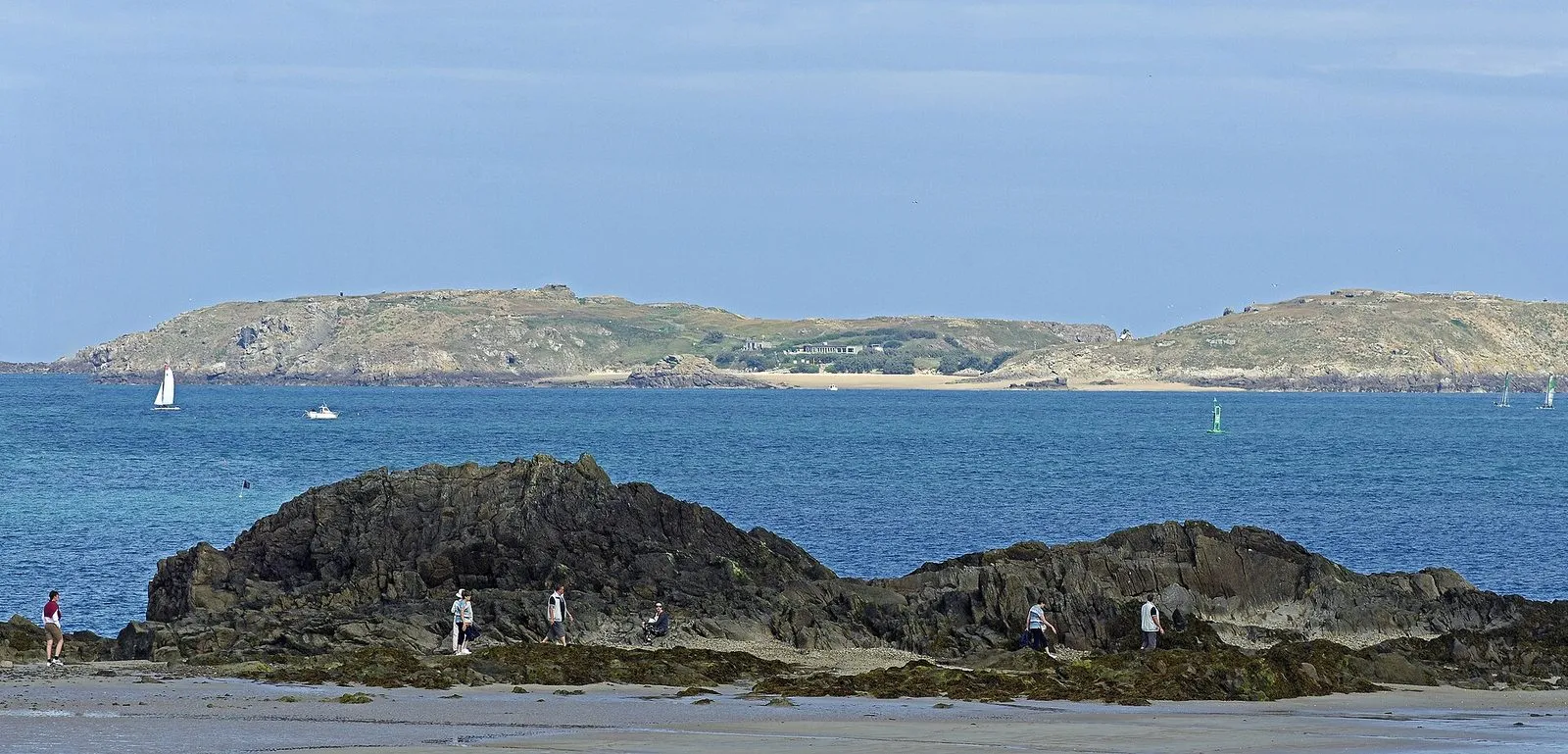

From the Sillon beach or the wall-walk on the ramparts, Cézembre is the low shape closing the horizon to the north-west. The island lies about 4 km out from Saint-Malo and belongs to the town. It is barely 650 metres long and 250 wide, rises to 38 metres and covers some ten hectares. It is the largest island in the bay and the only one open to visitors.
People go for three things: a sandy beach facing south, a short trail among the remains of 1944, and the view of the Emerald Coast from offshore. The rest of the island is fenced off, and it helps to know why before you step ashore.
Monks, cannon and bombs
Cézembre has been visited since prehistoric times. Until the end of the seventeenth century, hermits and monks lived there, and four chapels and a friary were built on it. English raids on the corsair town then led Vauban to fortify the island, which stayed in military hands until it was demilitarised in 1920. Saint-Malo families then took it back as a place for outings.
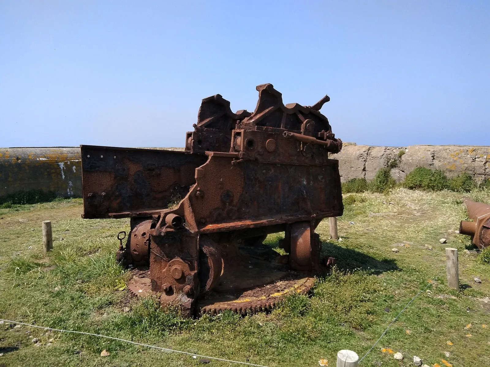
The Second World War changed everything. From 1942 the German army fortified the island and installed, among other weapons, six 194 mm guns: old French pieces with a range of close to 18 km. Around 400 men, mostly Kriegsmarine sailors, joined in summer 1944 by an Italian detachment, manned the battery under Richard Seuss.
From 6 August to 2 September 1944, Allied aircraft, naval guns and field artillery bombarded the island. According to the Ille-et-Vilaine département and the French maritime prefecture, aircraft dropped 1,700 tonnes of high-explosive bombs, 176 napalm bombs and 32 incendiaries. The shelling intensified after 17 August, once the Cité d’Aleth, the last German stronghold on the mainland, had surrendered and the Cézembre garrison still refused to give in. On 31 August the British battleship HMS Malaya joined the aircraft to soften the island up for a landing. Out of drinking water and with many wounded, the Italian troops raised the white flag on 1 September, and Seuss handed the island over on the morning of 2 September.
For such a small piece of land, those four weeks rank among the most intense bombardments of the war: accounts mention more than two thousand craters, and the département notes that the island is reputed to be the most heavily bombed spot of the conflict. Photographs from the time show the explosions seen from the rooftops of Saint-Malo.
What is open and what is still off limits
After the war the island stayed with the Ministry of Defence because of unexploded ordnance. The beach reopened to the public in 1950. In 2008, French Navy bomb-disposal divers cleared it to a depth of more than three metres and removed some 300 artillery shells and 200 other munitions.
In February and March 2017 a further operation cleared a strip three metres wide and 800 metres long across the western part of the island. The island now belongs to the Conservatoire du littoral, the national coastal protection agency, which has entrusted its management to the Ille-et-Vilaine département, with the Bretagne Vivante association monitoring wildlife.
In practice, the open part comes down to two areas:
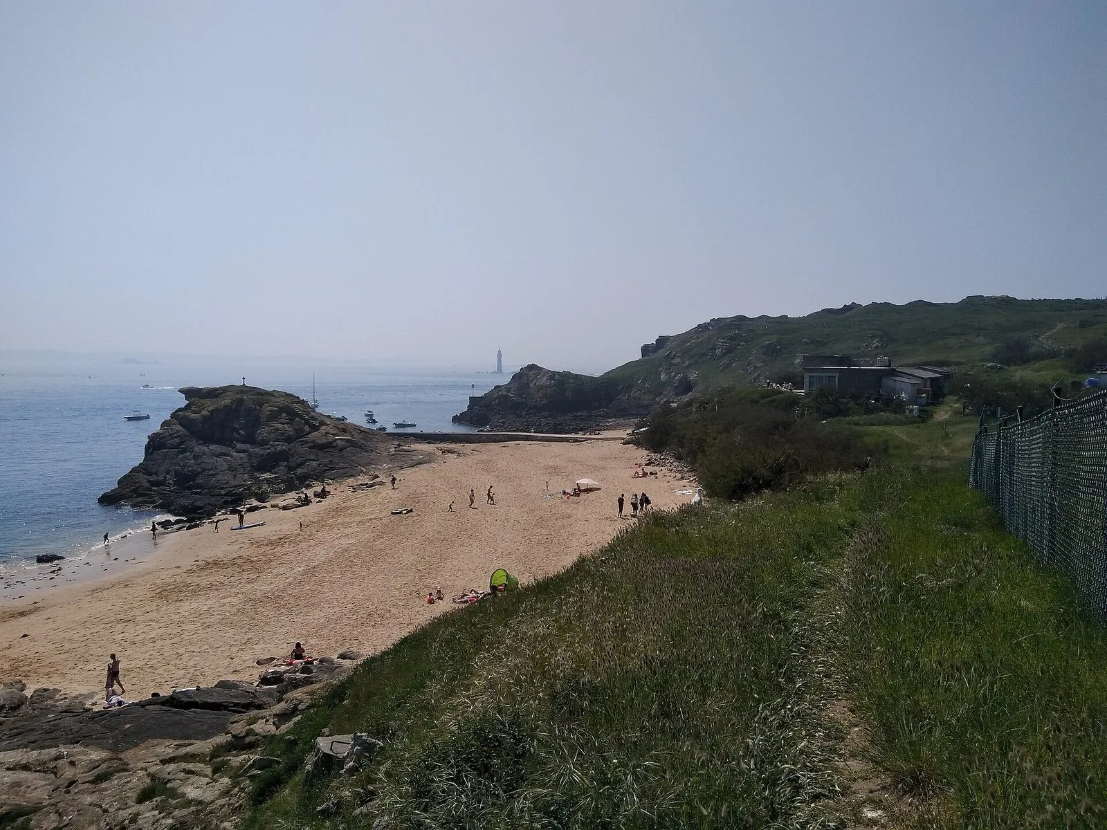
- the beach on the south side, next to the landing slipway;
- the waymarked, fenced trail, a loop of about 800 metres past the western batteries, the command post and the craters, to a viewpoint over the Grand Jardin lighthouse and the coast as far as Cap Fréhel.
The centre and east of the island remain closed. The trail normally opens from mid-April to mid-November, and a section may shut in spring so that shags, razorbills and gulls can nest in peace. In 2026 it reopened on 4 April, with one section closed until early summer.
The rules on the island
These are the site manager’s rules, and they are not negotiable:
- never leave the waymarked trail: beyond the fences, the ground has not been cleared;
- pick nothing up and touch no metal object, whether scrap, shell fragment or casing. A suspicious object gets reported, never moved;
- no fires, no picking plants, no disturbing the birds;
- swimming on the south side only;
- the island has no bins, no drinking water and no open toilets, so take your rubbish home;
- the landing slipway can be slippery with seaweed.
The département also states that boats may not enter a 100-metre strip around the island, except in the anchorage marked out to the south. If you are coming on your own boat, read the regulations on ille-et-vilaine.fr before you set off.
The south-facing beach
The beach looks across to Saint-Malo and Dinard, sheltered from northerly winds by the island itself. The boat companies describe it as one of the warmest in the area, and the sand is fine. It offers no shelter at all, though: no shade and nowhere to go if it rains. Bring plenty of water, a picnic, a hat and sunscreen, and check the forecast before you book. Shoes with a good grip help too, both on the wet slipway and on the trail as it winds between the craters.
An independent restaurant, Le Repaire des Corsaires, occupies the only building on the beach in season, with a terrace open in fine weather and tables by reservation. It has had interruptions in recent years, and in 2026 the Conservatoire du littoral and the département selected a new restaurant and visitor centre project for 2027. Make sure it is open before setting off without supplies.
Getting there by boat
The sea is the only way in. In 2026 two companies run the crossing, which takes about twenty minutes:
- Compagnie Corsaire, from Saint-Malo and Dinard: weekends in April, May, June and September, and daily in July and August;
- Les Bateaux Rouges, from the Gare Maritime de la Bourse in Saint-Malo, May to September, daily in July and August.
Both companies ban dogs from the island. Fares and operating days change from one season to the next, so check their websites. For other trips around the bay, the boat tours from Saint-Malo often pass close to the island.
Cézembre and the tide
In a bay where the sea rises and falls by several metres twice a day, the tide sets the timetable. Compagnie Corsaire warns that its times can shift with the tide, and in 2026 it cancelled the 18 and 19 July sailings for that reason. Les Bateaux Rouges likewise warn that some departures may be delayed or cancelled. Get your return time confirmed when you board, and check the official SHOM tide times before any trip out, on maree.shom.fr or our tide times page.
From the shore, Cézembre is a landmark for reading the bay. From the Bastion de la Hollande on the ramparts, you see it beyond the Grand Bé and Petit Bé; at low tide you can walk out to Fort National for a closer look, though never all the way to the island. To place all these points, open the map, and find other trips around the bay on our around Saint-Malo page.
Written and kept up to date by a Saint-Malo local in love with this coast. The story behind this guide


Check the official tide times on maree.shom.fr ↗
Frequently asked questions
How do you get to Cézembre island?
Only by sea. Two passenger-boat companies serve the island in season from Saint-Malo and Dinard, Compagnie Corsaire and Les Bateaux Rouges, and the crossing takes about twenty minutes. Sailings run mainly in summer and on some spring and September weekends, and some can be moved or cancelled because of the tide.
Can you visit the whole of Cézembre?
No. Only the beach and a loop trail of about 800 metres, cleared of explosives by the French Navy in 2017, are open to the public. The rest of the island still holds unexploded ordnance and is fenced off. Part of the trail may also close while seabirds are nesting.
Why was Cézembre bombed so heavily?
The German army fortified the island from 1942 and installed 194 mm guns covering the approaches to Saint-Malo harbour. Its garrison kept fighting after the town fell in August 1944. Allied aircraft, warships and artillery pounded the island from 6 August until its surrender on 2 September 1944.
Is there a restaurant on Cézembre?
An independent restaurant operates on the beach in season, with a terrace open in fine weather. Its opening has varied from year to year and a new operator has been chosen for 2027, so check before relying on it and bring your own food and water.
Can I take my dog to Cézembre?
No. Both boat companies serving the island state that dogs are not allowed there. Nesting seabirds along the trail are one of the reasons for the rule.